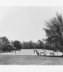
Circa 1930 photograph of the Swope Park tennis courts. This vantage point faces east from near the present intersection of Pavilion Road and Starlight Road.
Trees
Displaying 1 - 12 of 231
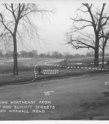
Photograph with caption, "looking northeast from 55th and Summit Streets toward Wornall Road." The photograph's annotations label streets and show proposed road improvements.
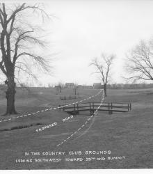
Photograph with caption, "in the Country Club grounds looking southwest toward 55th and Summit." The photograph's annotations show a proposed road.
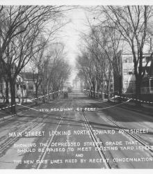
Photograph with caption, "Main Street looking north toward 40th Street showing the depressed street grade that should be raised to meet existing yard levels and the new new curb lines fixed by recent condemnation."
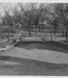
Photograph looking east on 53rd Street Terrace towards its intersection with Brookside Boulevard. Homes on the west side of Oak Street and the Country Club streetcar line are pictured in the background.
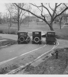
Photograph of three cars parked at the intersection of 53rd Street Terrace and Brookside Boulevard. This vantage point faces east-northeast from the southwest corner of the intersection. Homes on the west side of Oak Street and the Country Club streetcar line are pictured in the background.
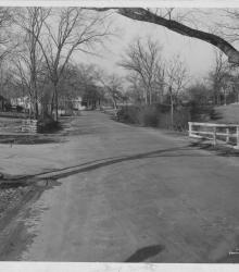
Photograph looking north on Brookside Boulevard just south of its intersection with 53rd Street Terrace.
Circa 1925 photograph of Locust Street looking north between 39th Street and 40th Street. Locust Street north of 39th Street and the residence at 3826 Locust are shown in the distance.
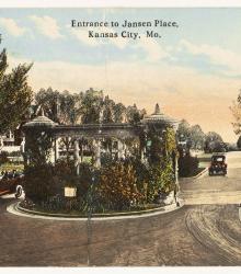
Postcard looking south towards the entrance to Janssen Place at the intersection of 36th Street and Janssen Place.
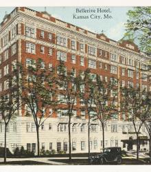
Postcard of the Bellerive Hotel at the northeast corner of Armour Boulevard and Warwick Boulevard. It was designed by Preston J. Bradshaw and opened on November 9, 1922.
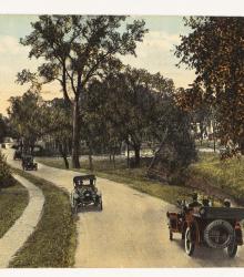
Postcard of the Country Club District, showing Brookside Boulevard. This vantage point faces north on the west side of Brookside Boulevard, just south of 54th Street. The description on the back of the postcard reads, "An interesting view in the country club district, one of Kansas City's best residence sections.
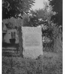
Photograph of the Santa Fe Trail marker located at the southeast corner of Blue Ridge Drive and 66th Street in present-day Raytown, Missouri. This vantage point face southeast with the Rice-Tremonti House in background partially showing. Marker placed by the DAR and the state of Missouri, 1909.