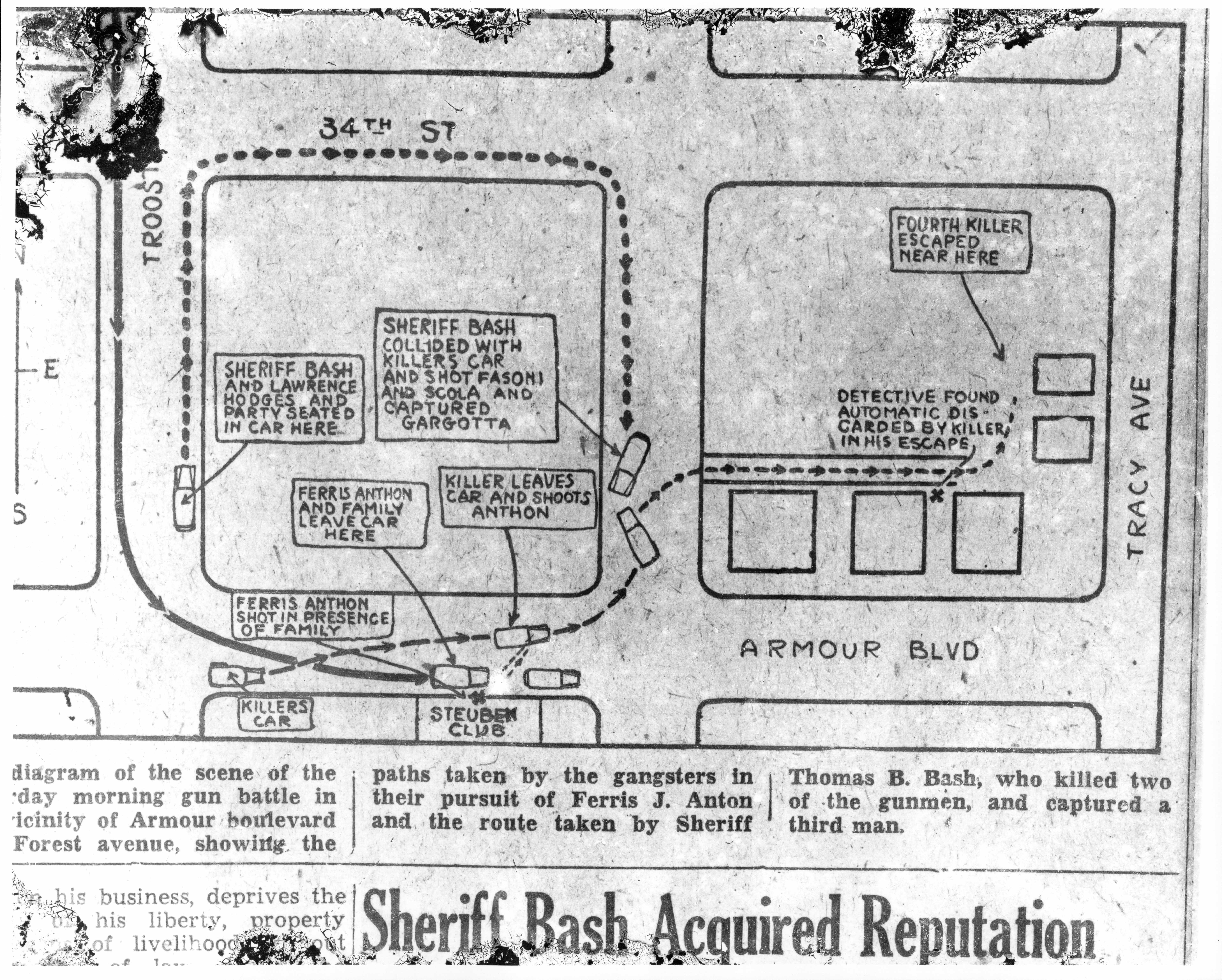
Map of Triple Killing on August 12, 1933
Description:
Map of the shootout between police and gangsters on the morning of August 12, 1933. The caption states, "A diagram of the scene of the Saturday morning gun battle in the vicinity of Amour boulevard and Forest avenue, showing the paths taken by the gangsters in their pursuit of Ferris J. Anton and the route taken by Sheriff Thomas B. Bash, who killed two of the gunmen, and captured a third man."
Creator:
Publisher:
Kansas City Journal-Post
Genre:
Date:
August 12th 1933
Owning Organization:
Modern Location:
Kansas City, MO
Neighborhood:
Historical Street Name:
Person Name:
Rights Statement:
Images and texts may be reproduced without prior permission only for purposes of temporary use, private study, scholarship, or research. Those using these images and texts assume all responsibility for questions of copyright and privacy that may arise.
Collection Title, Call or Box Number:
Zeldin Collection of Journal-Post Glass Negatives, P29, Box 19, Folder 23, #10
Digital Object Identifier:
10016227
