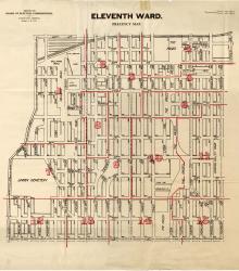
Map showing the boundaries of precincts as defined in 1918 for the eleventh ward of Kansas City, Missouri. This ward is bounded by 20th Street to the north, Grand Avenue (now Grand Boulevard) to the west, 31st Street to the south, and Michigan Avenue to the east.
Maps
Displaying 25 - 36 of 42
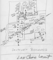
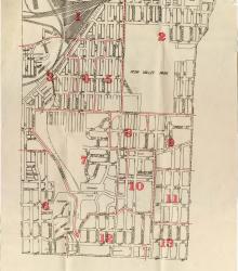
Hand drawn map of the Last Chance Saloon, which was built to span the Missouri/Kansas state line. The entry is located on Southwest Boulevard in Kansas, with gambling taking place behind several doors and upstairs, across the state line in Missouri.
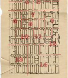
Map showing the boundaries of precincts as defined in 1918 for the sixth ward of Kansas City, Missouri. This ward is bounded by 9th Street to the north, Grand Avenue (now Grand Boulevard) to the west, 20th Street to the south, and Harrison Street to the east.
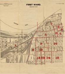
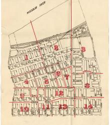
Map showing the boundaries of precincts as defined in 1918 for the first ward of Kansas City, Missouri. This ward is bounded by the Missouri River to the north, Kansas to the west, 14th Street to the south, and Grand Avenue (now Grand Boulevard) to the east.
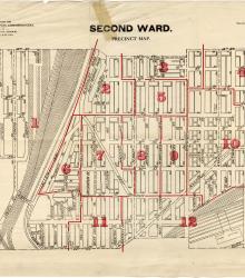
Map showing the boundaries of precincts as defined in 1918 for the second ward of Kansas City, Missouri. This ward is bounded by 14th Street to the north, Kansas to the west, 24th Street to the south, and Grand Avenue (now Grand Boulevard) to the east.
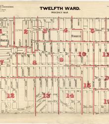
Map showing the boundaries of precincts as defined in 1918 for the twelfth ward of Kansas City, Missouri. This ward is bounded by 31st Street to the north, Main Street to the west, 39th Street to the south, and Garfield Avenue to the east.
Map showing the boundaries of precincts as defined in 1918 for the third ward of Kansas City, Missouri. This ward is bounded by 24th Street to the north, Kansas to the west, 39th Street to the south, and Main Street to the east.
Map showing the boundaries of precincts as defined in 1918 for the eighth ward of Kansas City, Missouri. This ward is bounded by 9th Street to the north, Harrison Street to the west, 20th Street to the south, and Euclid Avenue to the east.
Map showing the boundaries of precincts as defined in 1918 for the fifth ward of Kansas City, Missouri. This ward is bounded by the Missouri River to the north, Grand Avenue (now Grand Boulevard) to the west, 9th Street to the south, and Lydia Avenue to the east.
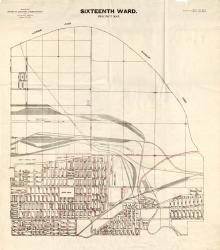
Map showing the boundaries of precincts as defined in 1918 for the sixteenth ward of Kansas City, Missouri. This ward is bounded by the Missouri River to the north, Monroe Avenue to the west, 9th Street to the south, and eastern city limits to the east.

Map showing the boundaries of precincts as defined in 1918 for the seventh ward of Kansas City, Missouri. This ward is bounded by the Missouri River to the north, Lydia Avenue to the west, 9th Street to the south, and Monroe Avenue to the east.
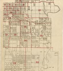
Map showing the boundaries of precincts as defined in 1918 for the thirteenth ward of Kansas City, Missouri. This ward is bounded by 35th Street to the north, Campbell and Troost Avenue to the west, south city limits to the south, and eastern city limits to the east.