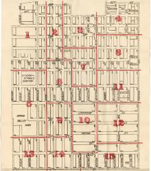
Map showing the boundaries of precincts as defined in 1918 for the tenth ward of Kansas City, Missouri. This ward is bounded by 20th Street to the north, Michigan Avenue to the west, 31st Street to the south, and Indiana Avenue to the east.
Maps
Displaying 37 - 42 of 42
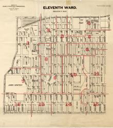
Map showing the boundaries of precincts as defined in 1918 for the eleventh ward of Kansas City, Missouri. This ward is bounded by 20th Street to the north, Grand Avenue (now Grand Boulevard) to the west, 31st Street to the south, and Michigan Avenue to the east.
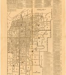
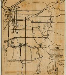
Map printed in The Missouri Democrat on June 25, 1926, showing the latest official district, ward, and precinct lines for Kansas City, MO as rearranged under a recent charter. Included with the map is the voting booth location for each precinct.
Spot map of Kansas City, Missouri indicating approximate place of residence of the members of the Committee of 1000. This committee was involved in the Ten Year Plan.
Map of Kansas City, Missouri indicating a proposed plan for expenditure of $8.3 million for major traffic arteries in Kansas City.
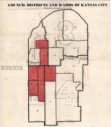
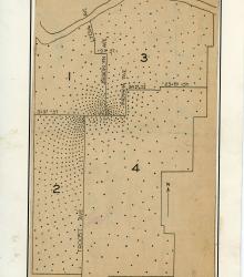
Map of Kansas City council districts and wards from the Missouri River south to the then-city limits at 77th and 79th Streets, and from the Kansas state line east to the eastern city limits. Shaded areas show increase in voter registrations of more than 10% between August and November 1940.
Pages
- « first
- ‹ previous
- 1
- 2
- 3
- 4