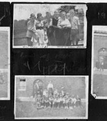
Grouping of four exterior snapshots of students with teachers on Kensington School lawn. All photographs except the top center picture were taken outside of the south facing southeast entrance to the school.
Historic East
Displaying 1 - 11 of 11
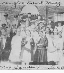
Photograph with an exterior view of a group of Kensington School 6th grade students posed on the school steps. Identified as Mrs. Sanders, teacher. The girls are identified on the back of the photograph. This vantage point faces north towards the main south entrance to the school.
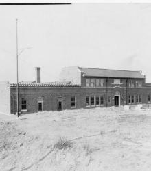
Photograph with a full, exterior view of Kensington School. This vantage point faces northwest on 17th Street between Brighton Avenue and Van Brunt Boulevard.

Photograph looking north on the east side Kensington Avenue between 14th Street and 15th Street (presently Truman Road). A man is pictured constructing a fence in front of 1411 and 1413 Kensington.
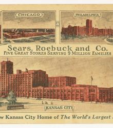
Postcard of the Sears, Roebuck & Company warehouse, administration, and retail buildings, built in 1925 at the southwest corner of 15th Street (now Truman Road) and Cleveland Avenue. Also pictured are company buildings in Dallas, Chicago, Philadelphia, and Seattle.
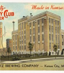
Postcard of the M. K. Goetz Brewing Company, built in 1936 at the northeast corner of 17th Street and Indiana Avenue. The card promotes Goetz Country Club Beer, "Made in Kansas City".
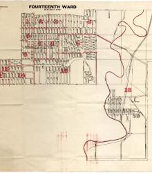
Map showing the boundaries of precincts as defined in 1918 for the fourteenth ward of Kansas City, Missouri. This ward is largely bounded by 23rd Street to the north, Indiana Avenue to the east, 35th Street to the south, and sections east of Blue River bounded by the eastern city limits to the east.
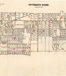
Map showing the boundaries of precincts as defined in 1918 for the fifteenth ward of Kansas City, Missouri. This ward is largely bounded by 9th Street to the north, Cleveland Avenue to the west, 23rd Street to the south, and eastern city limits to the east.
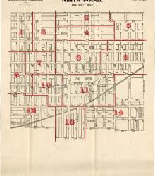
Map showing the boundaries of precincts as defined in 1918 for the ninth ward of Kansas City, Missouri. This ward is bounded by 9th Street to the north, Euclid Avenue to the west, 20th Street to the south, and Cleveland Avenue to the east.
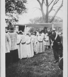
Photograph of Kansas City clergy preparing for the Corpus Christi Procession on Memorial Day at Mt. St. Mary's Cemetery.
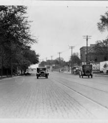
This photograph was taken looking east on 15th Street (now Truman Road) just west of Poplar Street. Billboard posters for Benzo-Gas and Milky Way are shown.