
Photograph of members of the East Central Garden Club of Kansas visiting Loose Park in Kansas City, Missouri. Nine women are pictured accompanied by five children. Trees, a pond, and pathways are pictured in the background, and a young girl in the front row holds a camera.
Sunset Hill
Displaying 1 - 12 of 77
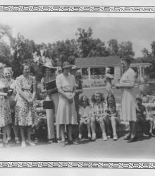
Photograph of members of the East Central Garden Club of Kansas visiting Loose Park in Kansas City, Missouri. Nine women are pictured accompanied by five children. A shelter with attached pergola can be seen in the background of the image.
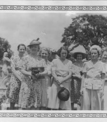
Photograph of members of the East Central Garden Club of Kansas visiting Loose Park in Kansas City, Missouri. The image shows ten women, some largely obscured, with the park's noted rose garden in the background.
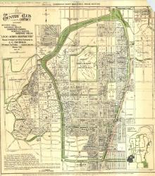
Map of "The Country Club District including Sunset Hill, Mission Hills, Hampstead Gardens, Wornall Manor, Greenway Fields, '1,500 Acres Restricted', Planned, Developed and Offered Exclusively by J. C.
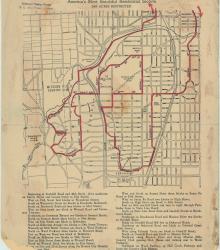
Street map of a "Scenic Route Through the Country Club District: America's Most Beautiful Residential Section, 2000 Acres Restricted." The scenic route is indicated in red; specific directions are at bottom of map. Map shows Kansas City Country Club, Mission Hills Country Club, and names of neighborhoods.
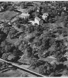
Circa 1930 photograph with an aerial view looking northeast at the intersection of Ward Parkway and State Line Road, showing the campus of Pembroke Country Day School and Brush Creek.
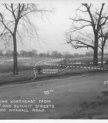
Photograph with caption, "looking northeast from 55th and Summit Streets toward Wornall Road." The photograph's annotations label streets and show proposed road improvements.
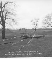
Photograph with caption, "in the Country Club grounds looking southwest toward 55th and Summit." The photograph's annotations show a proposed road.
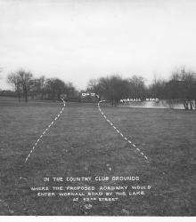
Photograph with caption, "in the Country Club grounds where the proposed roadway would enter Wornall Road by the lake at 5nd Street." This vantage point faces northeast near the center of present day Loose Park.
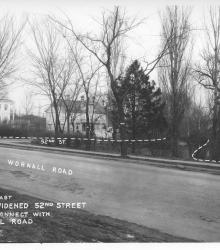
Photograph with caption, "looking east where widened 52nd Street would connect with Wornall Road." The photograph's annotations label streets and show proposed road improvements.

Circa 1925 photograph of the Sunset Hill Line streetcar looking south from the intersection of 48th Street and Belleview Avenue. The streetcar's bridge over Brush Creek, Ward Parkway, and Sunset Hill are pictured in the background.
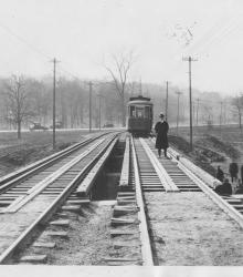
Circa 1925 photograph of a man posed on top of the Sunset Hill Line streetcar bridge over Brush Creek at Belleview Avenue. This vantage point faces south to where the streetcar joins Ward Parkway in the background.