Photograph of the stockyards in the West Bottoms of Kansas City, Missouri. This vantage point faces northwest towards Kansas City, Kansas in the far background and was taken west of Genessee Street and east of the Missouri-Kansas border.
West Bottoms
Displaying 37 - 48 of 75
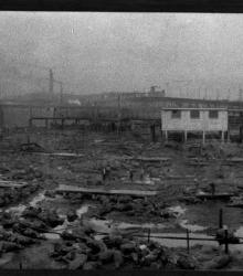
A panoramic photograph showing a fire at the stockyards in Kansas City, Missouri. Many cattle were killed.
Photograph of "Hell’s Half Acre", an area in the late 1800's and early 1900's consisting of the north side of the West Bottoms between the bluffs and the state line. This vantage point faces northwest from the bluffs near 7th Street and shows 8th Street between Mill Street (now Madison Avenue) and Sante Fe Street.
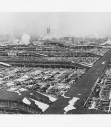
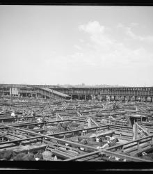
Circa 1930's photograph of the Kansas City stockyards looking northwest from atop the Kansas City Live Stock Exchange Building.
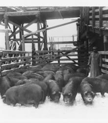
Photograph of a man with pigs in the stockyards. The original slide included the following description: "Moving a pen of Berkshire hogs at the Stock Yards, Kansas City, Missouri."
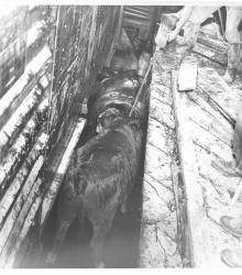
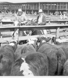
Photograph from the stockyards with partial view of men prodding cattle in a livestock pen with a broomhandle.

Photograph of a man spraying water from a large hose near another man riding a tractor in the Kansas City Stockyards. Handwritten in pencil on the back of photo are the words: "Cleaning pen before another feeding."
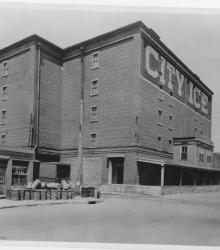
Circa 1930 photograph with frontal and side view of City Ice Company of Kansas City, Plant No. 2; located at southwest corner of 8th Street and Hickory Street and built in 1898. This vantage point faces northwest from the east side of Hickory Street just north of 9th Street.
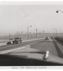
Photograph, which appears to be taken between 1930 and 1940, taken from inside a vehicle driving on the Inter-City Viaduct, looking east with the Kansas City, Missouri skyline in view in the background. The viaduct connects Kansas City, Kansas, and Kansas City, Missouri.
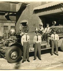
Photograph of Kansas City Fire Department Number 15, Kansas City, Missouri, opened in 1925. Pictured are Captain Eugene King, Driver Herman Lewis, and firefighters George P. Smith, Clarence Hill, and Joseph D. Johnson. This vantage point faces northeast on Mulberry Street between 8th and 9th Street. A defunct viaduct is shown at the top left.
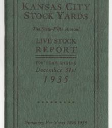
Livestock report prepared for the year ending December 31, 1935, for the Kansas City Stock Yards, detailing shipments and receipts of livestock throughout that year, as well as summarizing statistics from previous years. Statistics for 1935 are sorted by railroad, year, type of livestock, and by state.