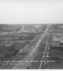
Photograph with caption, "Brush Creek Boulevard and Country Club Plaza [looking west] from roof of Sophian Plaza." The annotations on the photogaph label streets and show proposed road improvements.
Westport
Displaying 61 - 72 of 515
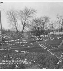
Photograph with caption, "Proposed roadway connections, in Park Land, north of 43rd Street." This vantage point faces north-northwest from near the intersection of 43rd Street and Baltimore Avenue.
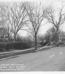
Photograph with caption, "looking northeast along 52nd Street from Central Street." The photograph's annotations label streets and show proposed road improvements.
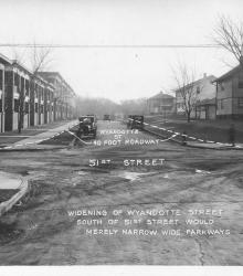
Photograph with caption, "widening of Wyandotte Street south of 51st Street would merely narrow wide parkways." This vantage point faces south on Wyandotte Street from just north of 51st Street. The photograph's annotations label streets and show proposed road improvements.
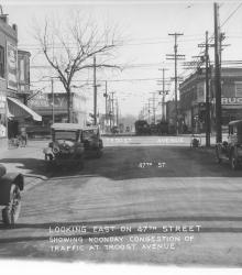
Photograph with caption, "looking east on 47th Street showing noonday congestion of traffic at Troost Avenue." Piggly Wiggly and Crown Drug Co. are pictured.
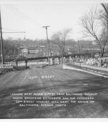
Photograph with caption, "looking west along 43rd St. from Baltimore Avenue where Brookside Extension and the proposed 43rd Street Viaduct will meet the grade of Baltimore Avenue north." The photograph's annotations label streets and show proposed road improvements.
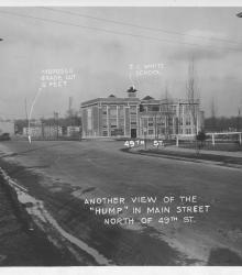
Photograph with caption, "Another view of the 'hump' in Main Street north of 49th St." This vantage point faces north-northeast on the west side of Main Street just south of 49th Street.
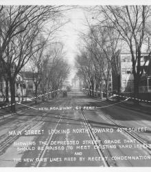
Photograph with caption, "Main Street looking north toward 40th Street showing the depressed street grade that should be raised to meet existing yard levels and the new new curb lines fixed by recent condemnation."
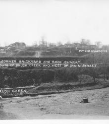
Photograph with caption, "The former brickyard and rock quarry south of Brush Creek and west of Main Street." This vantage point faces south from near the intersection of Wyandotte Street and Ward Parkway and shows annotations labeling Brush Creek and street intersections.
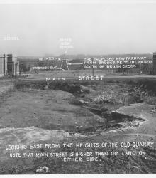
Photograph with caption, "looking east from the heights of the old quarry. Note that Main Street is higher than the land on either side."
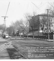
Photograph with caption, "Main Street at 41st, looking north showing the proposed diagonal connection with Brookside Boulevard and new 60 foot roadway as fixed by recent condemnation." The photograph's annotations label streets and show proposed road improvements.
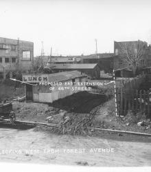
Photograph with caption, "looking west from Forest Avenue" just south of 47th Street and showing the proposed east extension of 48th Street.