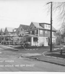
Photograph with caption, "northeast corner of Baltimore Avenue and 42nd Street." The photograph's annotations label streets and show proposed road improvements.
Westport
Displaying 73 - 84 of 515
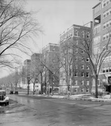
Circa 1934 photograph looking west down Armour Boulevard from Locust Street. The building in on the right is the Georgian Court at the corner of Armour Boulevard and Locust Street. Beyond that is Park Central under construction.
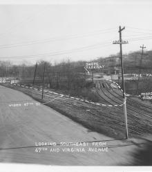
Photograph with caption, "looking southeast from 47th and Virginia Avenue." The photograph's annotations label streets and show proposed road improvements, including plans to widen 47th Street. Paseo High School is pictured.
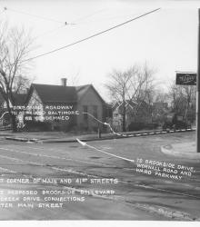
Photograph with caption, "southwest corner of Main and 41st Streets where the proposed Brookside Boulevard and Mill Creek Drive connections would enter Main Street." The photograph's annotations show proposed road improvements.
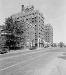
Photograph of the LaSalle Hotel at the northwest corner of Linwood Boulevard and Harrison Street. This vantage point faces east from the south side of Linwood near the intersection of Campbell Street.
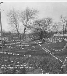
Photograph with caption, "Proposed roadway connections, in Park Land, north of 43rd Street." This vantage point faces north-northwest from near the intersection of 43rd Street and Baltimore Avenue.
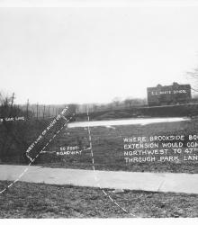
Photograph with caption, "where Brookside Boulevard Extension would come northwest to 47th Street through Park Land." This vantage point faces south from just south of the intersection of Main Sreet and 47th Street.
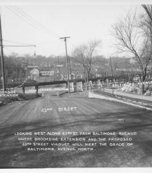
Photograph with caption, "looking west along 43rd St. from Baltimore Avenue where Brookside Extension and the proposed 43rd Street Viaduct will meet the grade of Baltimore Avenue north." The photograph's annotations label streets and show proposed road improvements.
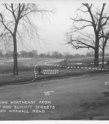
Photograph with caption, "looking northeast from 55th and Summit Streets toward Wornall Road." The photograph's annotations label streets and show proposed road improvements.
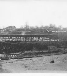
Photograph with caption, "The former brickyard and rock quarry south of Brush Creek and west of Main Street." This vantage point faces south from near the intersection of Wyandotte Street and Ward Parkway and shows annotations labeling Brush Creek and street intersections.
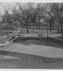
Photograph looking east on 53rd Street Terrace towards its intersection with Brookside Boulevard. Homes on the west side of Oak Street and the Country Club streetcar line are pictured in the background.
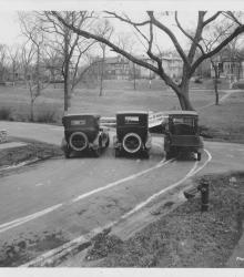
Photograph of three cars parked at the intersection of 53rd Street Terrace and Brookside Boulevard. This vantage point faces east-northeast from the southwest corner of the intersection. Homes on the west side of Oak Street and the Country Club streetcar line are pictured in the background.