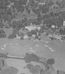
An aerial view of the Mission Hills Country Club showing the completed club house, with State Line Road running across the center of the picture. After the Mission Hills Country Club moved across the border to Kansas, the building pictured center became part of the Carriage Club.
The State Historical Society of Missouri-Kansas City
Displaying 265 - 276 of 287
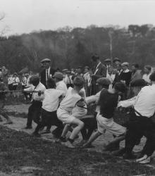
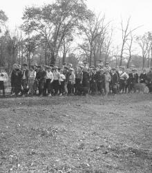
A dozen boys playing tug-of-war while a Community Field Day crowd watches on the grounds of the Pembroke-Country Day School. This vantage point faces east towards Brush Creek and Ward Parkway.
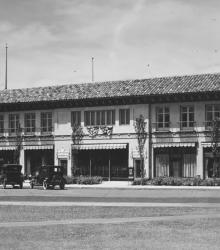
This picture of the Suydam Building was taken in the Country Club Plaza looking west-southwest on Mill Creek Parkway (now J C Nichols Parkway) just north of 47th Street. The Suydam Building was later occupied by the House of Beauty and the Claude Keyes Drug Store.
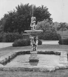
Fountain at Brookwood Road and State Line Road, found by Mr. Nichols while traveling in London. This vantage point faces west on Brookwood Road just west of State Line Road in Mission Hills, Kansas.
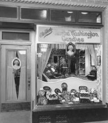
Martha Washington Candy Shop located at 215 West 47th Street. This vantage point faces south on 47th Street between Wyandotte Street and Central Street.
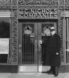
Most any morning about 8:30 found Mr. J. C. Nichols entering the office at 310 Ward Parkway. Iron grillwork originally on the main doors was removed because doors were too heavy to be pushed open easily. This vantage point faces north on Ward Parkway between Central Street and Broadway Boulevard.
Saturday morning cross country hikes for the boys of the Country Club District, arranged by Miss Louise Hook, Community Secretary.
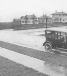
Looking west at 61st Terrace and Summit Street. In the foreground is an automobile, and in the background is a row of houses.
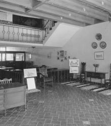
First floor lobby of the J. C. Nichols Companies building at 310 Ward Parkway, Kansas City, Missouri.
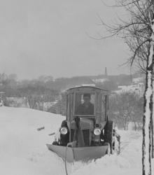
Motorized snowplows are called into action to clear the sidewalks of J. C. Nichols Companies homes in the Oak Meyer Gardens subdivision. This vantage point faces west on 65th Street just west of Cherry Street. Southwest High School at Wornall Road and 65th Street can be seen in the far background.
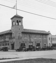
This picture of the Tower Building and Wolferman Building was taken looking north-east at the intersection of 47th Street and Wyandotte Street.
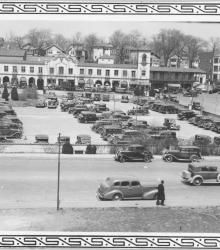
This picture was taken looking north from atop the J. C. Nichols Building, between Broadway and Central Street, Alameda Road and Ward Parkway. The parking lot was located between Broadway and Central Street, Alameda Road and 47th Street. The Plaza Balcony Building is shown in background.