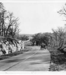
Photograph of Noland Road, south of U.S. Highway 40, looking South. The image is taken in Jackson County, Missouri, and is typical of the county's highways in the 1930s. The entrance to Little Blue Road is pictured in the far background.
Chamber of Commerce, Kansas City, MO
Displaying 1 - 12 of 23
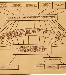
Organizational chart for Kansas City's Ten Year Plan, ca. 1930s, showing how the Civic Improvement Committee, Executive Committee, Finance Committee, Campaign Committee, and various city organizations relate to each other in regards to the sixteen listed Ten Year Plan projects.
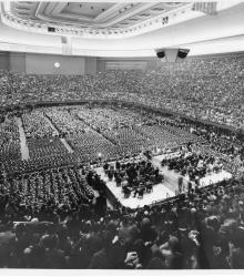
Photograph of the interior of Municipal Auditorium in Kansas City during President Franklin Roosevelt's address, October 13, 1936.
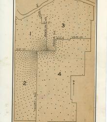
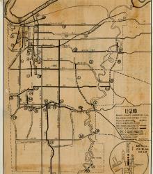
Spot map of Kansas City, Missouri indicating approximate place of residence of the members of the Committee of 1000. This committee was involved in the Ten Year Plan.
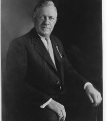
Portrait photograph of Conrad H. Mann, chairman of the Chamber of Commerce and architect of the Ten Year Plan.
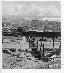
Photograph of the "9th Street Incline" cable car bridge. This vantage point faces west-northwest towards the West Bottoms and downtown Kansas City, Kansas in the far background.
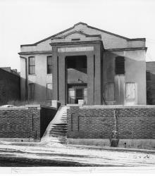
Photograph of the Old Detention Home on Oak Street, south of Fifth Street, ca. 1930s. This vantage point faces west-southwest on Oak Street.
Map of Kansas City, Missouri indicating a proposed plan for expenditure of $8.3 million for major traffic arteries in Kansas City.
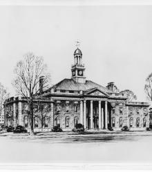
Architectural rendering of the Jackson County Courthouse in Independence, Missouri, after renovations in 1933. Later known as the Truman Courthouse.
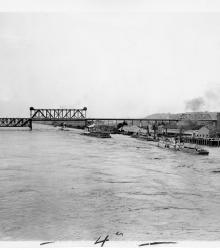
Armour-Swift-Burlington Bridge, with the Mark Twain and the General Ashburn, stern wheelers, carrying Patrick J. Hurley, Secretary of War, and his party on a trip to demonstrate the navigability of the Missouri River. This vantage point faces east towards the bridge and the south bank of the Missouri River.
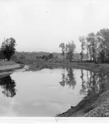
Photograph of improvements made to Blue River south to the limits of Swope Park, Kansas City, for purposes of flood control, ca. 1930s. This vantage point faces southwest from just south of 15th Street (now Truman Road). This photograph was taken before the river was diverted to west of Manchester Avenue (now Manchester Trafficway).
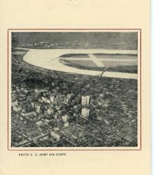
Pamphlet with information concerning Kansas City's Municipal Airport, Richards Field. The document provides the airport's specifications including: class, position, description, obstructions, lighting, accommodations, communication and signal, equipment, meteorological data, and other facts and figures.