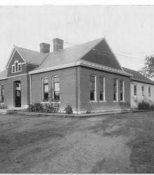
Photograph of the Swope School, once located at the northeast corner of Cleveland Avenue and 55th Street. It was named after Thomas H. Swope. This vantage point faces northeast from the northeast corner of Cleveland and 55th.
Swope Parkway – Elmwood
Displaying 1 - 4 of 4
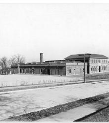
Photograph of the Mark Twain Public School, once located on the north side of 60th Street between Swope Parkway and Jackson Avenue. This vantage point faces northeast from the property at 3825 East 60th Street.
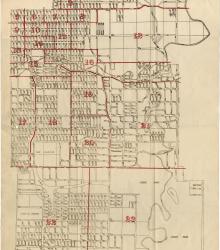
Map showing the boundaries of precincts as defined in 1918 for the thirteenth ward of Kansas City, Missouri. This ward is bounded by 35th Street to the north, Campbell and Troost Avenue to the west, south city limits to the south, and eastern city limits to the east.
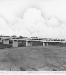
Photograph of the bridge over the Blue River at 63rd Street, which provided access to the Jackson County road system. This vantage point faces northwest towards the bridge from south of 63rd Street and east of Blue River.