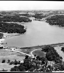
Aerial photograph of Lake Quivira looking south across the dam along the length of the lake in 1931 or 1932. The Lake Quivira Country Club clubhouse and Crescent Beach are visible on the left side of the image.
Aerial photographs
Displaying 1 - 12 of 12
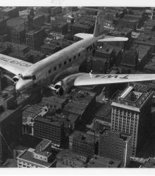
Photograph of a Douglas DC-2-112 airplane owned by Transcontinental & Western Air flying south over downtown Kansas City, Missouri. This vantage point faces north-northwest with the Commerce Building at the northwest corner of Walnut Street and 10th Street (white building, right-foreground).
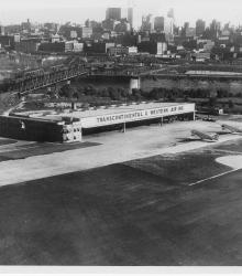
Photograph of three Douglas DC-2 airplanes parked outside of the Transcontinental & Western Air, Inc. airplane hangar at the Municipal Airport. This vantage point faces southeast towards the Hannibal Bridge and downtown Kansas City in the background.
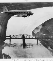
Photograph of a Douglas Commercial DC-1 airplane flying north over the Missouri River. This vantage point faces west-southwest with the Hannibal Bridge and the West Bottoms (top-background) pictured.
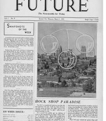
Issue of the anti-corruption, Kansas City-based newspaper, Future: The Newsweekly for Today.
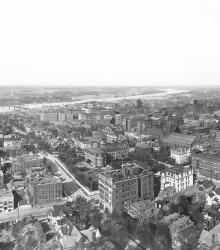
Downtown Kansas City as shown from an aerial view before the 1928 Republican National Convention begins on June 12 at Convention Hall. This elevated vantage point faces northeast and shows the Convention Hall in the right-center foreground. The Missouri River is pictured in the far right background.
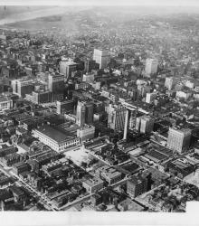
Aerial view of Kansas City, Missouri, looking north-northeast with the Missouri River in the background.
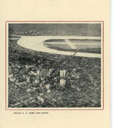
Pamphlet with information concerning Kansas City's Municipal Airport, Richards Field. The document provides the airport's specifications including: class, position, description, obstructions, lighting, accommodations, communication and signal, equipment, meteorological data, and other facts and figures.
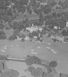
An aerial view of the Mission Hills Country Club showing the completed club house, with State Line Road running across the center of the picture. After the Mission Hills Country Club moved across the border to Kansas, the building pictured center became part of the Carriage Club.
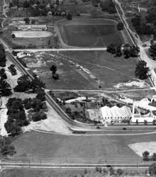
This aerial photograph of the Country Club Plaza was taken near Oak Street just south of 47th Street (now Emanuel Cleaver II Boulevard).
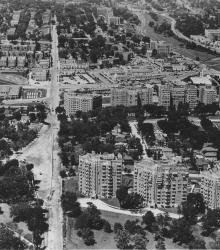
An aerial view of the Country Club Plaza in 1930, looking north from the top of the Wornall Road hill. The Walnut Apartments complex is in the foreground.
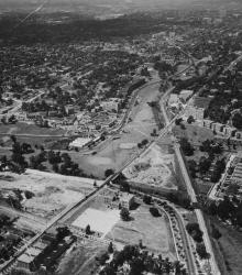
An aerial view of the Country Club Plaza in 1925, looking north-northwest near Brookside Boulevard and 51st Street.