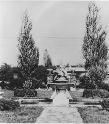
Photograph of Romanelli Fountain at the intersection of 69th Street, Edgevale Road, and Wornall Road. This vantage point faces east towards Wornall Road.
Armour Fields
Displaying 1 - 12 of 37
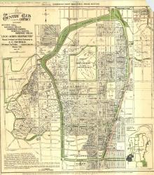
Map of "The Country Club District including Sunset Hill, Mission Hills, Hampstead Gardens, Wornall Manor, Greenway Fields, '1,500 Acres Restricted', Planned, Developed and Offered Exclusively by J. C.
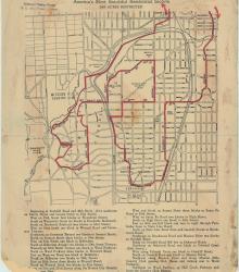
Street map of a "Scenic Route Through the Country Club District: America's Most Beautiful Residential Section, 2000 Acres Restricted." The scenic route is indicated in red; specific directions are at bottom of map. Map shows Kansas City Country Club, Mission Hills Country Club, and names of neighborhoods.
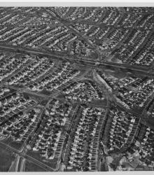
Circa 1930 photograph with an aerial view of residential districts Armour Fields (foreground) and Armour Hills (background) near 69th and Wornall Road. This vantage point faces east-northeast.
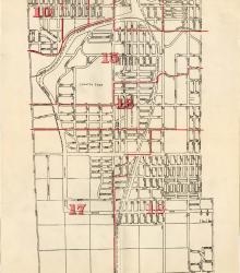
Map showing the boundaries of precincts as defined in 1918 for the fourth ward of Kansas City, Missouri. This ward is bounded by 39th Street to the north, Kansas to the west, south city limits to the south, and Campbell Street and Troost Avenue to the east.
Essay documenting the relationship between the author's father Alex Sachs and Harry S. Truman. The author addresses their first meeting, Pendergast Machine involvement, and immigration of family members from Germany to the United States. Howard Sachs also includes details of their relationship post-World War II.
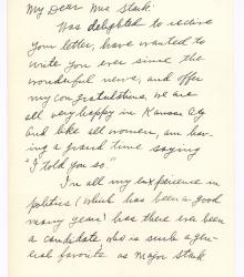
Letter from Effie Estes to Katherine Stark providing an update on her life circumstances and congratulating her for her husband's candidacy for governor of Missouri.
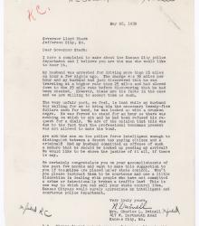
Letter from Mrs. Charles L. Dwinell to Governor Lloyd C. Stark, complaining about the treatment of her husband by the police after he was stopped for speeding. She reports that he was put in a cell with no chair while waiting for her to arrive to post bond, despite being stopped for driving 11 miles over the speed limit.
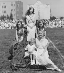
Five women, the "Goddesses" observing annual Country Club District Community Field Day at Southwest High School at the southwest corner of 65th Street and Wornall Road. This vantage point faces east towards rear of the high school from near the center of the football field.
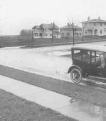
Looking west at 61st Terrace and Summit Street. In the foreground is an automobile, and in the background is a row of houses.
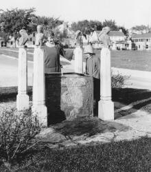
Romanelli Gardens, the northeast portion of the Armour Farm, just west of Wornall Road and south of 67th Street, has been added to the developing section of the Country Club District. This vantage point faces north-northeast at the intersection of Pennsylvania Avenue and 68th Terrace were this fountain was once located.

Completed construction of Southwest High School at 65th Street and Wornall Road.