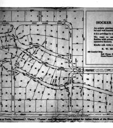
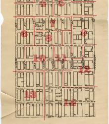
Plat map illustrating available lots for development in the Hocker Grove subdivision in Merriam, Kansas, circa 1915. The subdivision, between 55th Street on the north and Johnson Drive (then Main Street) on the south, was located west of Turkey Creek and developed by Richard W. Hocker.
Maps
Displaying 1 - 12 of 21
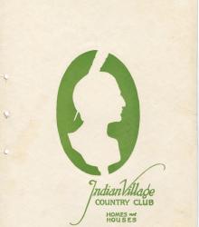
Promotional booklet for building family homes in 1920s luxury Kansas City suburban tract development now in the Santa Fe Hills neighborhood southeast of 85th St. and Wornall. It was to include rare amenities such as an open air theater, bell tower, pool, club house, and Dutch windmill.
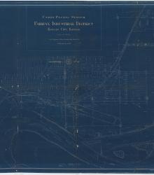
Blueprint map of the Fairfax Industrial District in Kansas City, Kansas, showing Union Pacific Railroad facilities, tracks, and other properties, as well as depicting features of the Missouri and Kansas Rivers and mapping city streets and the rail lines of other companies.
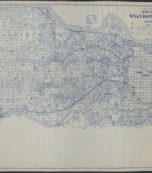
This map of Wyandotte County, KS, shows the land owners on sections in townships 10-12 south, and ranges 23-25 east. It includes the towns of Quindaro, Shawnee, Kansas City, Edwardsville, and Bonner Springs. In addition, roads, railroads, electric railways, schools, churches, cemeteries, streams, and rivers are marked on the map.
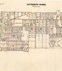
Map showing the boundaries of precincts as defined in 1918 for the fifteenth ward of Kansas City, Missouri. This ward is largely bounded by 9th Street to the north, Cleveland Avenue to the west, 23rd Street to the south, and eastern city limits to the east.
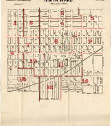
Map showing the boundaries of precincts as defined in 1918 for the ninth ward of Kansas City, Missouri. This ward is bounded by 9th Street to the north, Euclid Avenue to the west, 20th Street to the south, and Cleveland Avenue to the east.
Map showing the boundaries of precincts as defined in 1918 for the tenth ward of Kansas City, Missouri. This ward is bounded by 20th Street to the north, Michigan Avenue to the west, 31st Street to the south, and Indiana Avenue to the east.
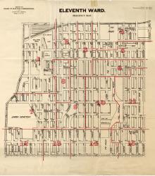
Map showing the boundaries of precincts as defined in 1918 for the eleventh ward of Kansas City, Missouri. This ward is bounded by 20th Street to the north, Grand Avenue (now Grand Boulevard) to the west, 31st Street to the south, and Michigan Avenue to the east.
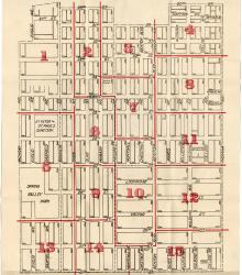
Map showing the boundaries of precincts as defined in 1918 for the sixth ward of Kansas City, Missouri. This ward is bounded by 9th Street to the north, Grand Avenue (now Grand Boulevard) to the west, 20th Street to the south, and Harrison Street to the east.
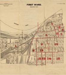
Map showing the boundaries of precincts as defined in 1918 for the first ward of Kansas City, Missouri. This ward is bounded by the Missouri River to the north, Kansas to the west, 14th Street to the south, and Grand Avenue (now Grand Boulevard) to the east.
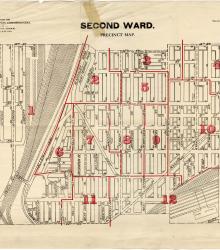
Map showing the boundaries of precincts as defined in 1918 for the second ward of Kansas City, Missouri. This ward is bounded by 14th Street to the north, Kansas to the west, 24th Street to the south, and Grand Avenue (now Grand Boulevard) to the east.
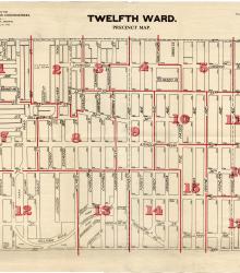
Map showing the boundaries of precincts as defined in 1918 for the twelfth ward of Kansas City, Missouri. This ward is bounded by 31st Street to the north, Main Street to the west, 39th Street to the south, and Garfield Avenue to the east.