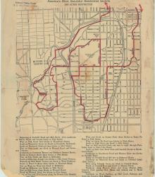
Street map of a "Scenic Route Through the Country Club District: America's Most Beautiful Residential Section, 2000 Acres Restricted." The scenic route is indicated in red; specific directions are at bottom of map. Map shows Kansas City Country Club, Mission Hills Country Club, and names of neighborhoods.
Holmes Park
Displaying 1 - 12 of 20
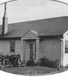
Photograph of the Meyer Boulevard Evangelical Church located at the southwest corner of Meyer Boulevard and Rockhill Road. It was known later as the Trinity Evangelical Church. This vantage point faces southeast from the south side of Meyer Boulevard between Charlotte Street and Rockhill Road.
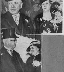
Clipping from the Kansas City Star on April 24, 1935 showing Thomas J. Pendergast, Carolyn E. Pendergast, Governor Guy B. Park, and Eleanora G. Park attending the marriage of Thomas J. Pendergast, Jr. and Mary Louise Weyer. The caption states, "Bridegroom's Parents (upper) - Mr. and Mrs. T. J.
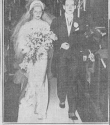
Clipping from the Kansas City Post on April 24, 1935 showing Thomas J. Pendergast, Jr. and Mary Louis Weyer Pendergast leaving St. Peter's Catholic Church after their marriage.
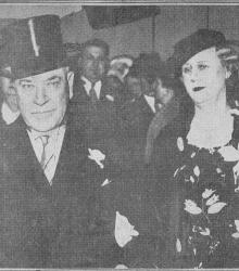
Clipping from the Kansas City Post on April 24, 1935 showing Thomas J. Pendergast and Carolyn E. Pendergast attending the marriage of Thomas J. Pendergast, Jr. and Mary Louise Weyer. The caption states, "Pendergasts at Wedding - Mr and Mrs. Thomas J.
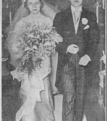
Clipping entitled "Mr. and Mrs. T. J. Pendergast, Jr., at the Church" from the Kansas City Star on April 24, 1935 showing Thomas J. Pendergast, Jr. and Mary Louis Weyer Pendergast leaving St. Peter's Catholic Church after their marriage.
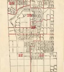
Map showing the boundaries of precincts as defined in 1918 for the fourth ward of Kansas City, Missouri. This ward is bounded by 39th Street to the north, Kansas to the west, south city limits to the south, and Campbell Street and Troost Avenue to the east.
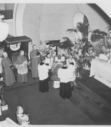
Photograph of the St. Peter's Church altar during the Silver Jubilee for Monsignor James N. V. McKay, pastor of St. Peter's.
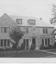
Circa 1940 photograph of the rectory for St. Peter's Church. This vantage point faces east on Holmes Road between Meyer Boulevard and 64th Terrace.
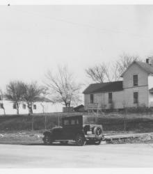
Mid-1920's photograph of St. Peter's Church (left) and Rectory (right) on the south side of Meyer Boulevard between Holmes Street and Charlotte Street. This original corrugated iron church building was known by the congregation as the "Tin Cathedral".
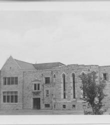
Circa 1940 photograph of St. Peter's Church and School at 6400 Charlotte Street. This vantage point faces east-northeast with Meyer Boulevard pictured on the left.
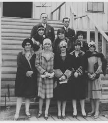
Photograph of the St. Peter's Church Choir posed outside of the entrance to the original corrugated iron church building, known by the congregation as the "Tin Cathedral". This vantage point faces south on the south side of Meyer Boulevard between Holmes Street and Charlotte Street.