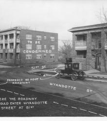
Photograph with caption, "Where the roadway would enter Wyandotte Street at 51st." This vantage point faces northeast from near the intesection of Wyandotte and 51st. The photograph's annotations label streets and show proposed road improvements.
Apartment houses
Displaying 25 - 36 of 37
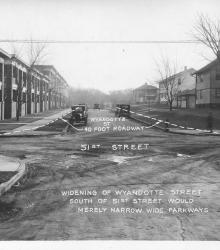
Photograph with caption, "widening of Wyandotte Street south of 51st Street would merely narrow wide parkways." This vantage point faces south on Wyandotte Street from just north of 51st Street. The photograph's annotations label streets and show proposed road improvements.
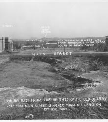
Photograph with caption, "looking east from the heights of the old quarry. Note that Main Street is higher than the land on either side."
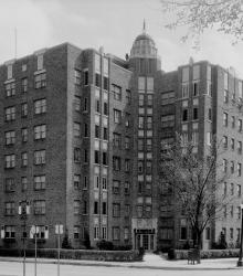
Photograph of the Mark Twain Apartment building located at the southeast corner of 48th Street and Roanoke Parkway.
Circa 1934 photograph looking west down Armour Boulevard from Locust Street. The building in on the right is the Georgian Court at the corner of Armour Boulevard and Locust Street. Beyond that is Park Central under construction.

Photograph with caption, "proposed trafficway in 48th Street looking west from Oak Street."
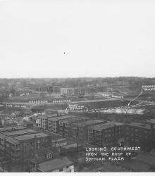
Photograph with caption, "looking southwest from the roof of Sophian Plaza" at the northwest corner of Warwick Boulevard and Brush Creek Boulevard (presently Emanuel Cleaver II Boulevard). The Country Club Car Line and E.C. White School (center background) are pictured.
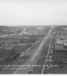
Photograph with caption, "Brush Creek Boulevard and Country Club Plaza [looking west] from roof of Sophian Plaza." The annotations on the photogaph label streets and show proposed road improvements.
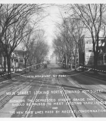
Photograph with caption, "Main Street looking north toward 40th Street showing the depressed street grade that should be raised to meet existing yard levels and the new new curb lines fixed by recent condemnation."
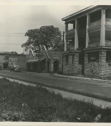
Photograph of the Black Hawk Barbecue restaurant, as well as the Lydia Market and Lydia Plaza buildings in the background. This vantage point faces northwest from the southwest corner of The Paseo and 14th Street.
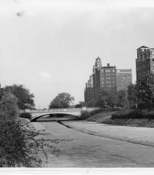
Photograph showing improvements to Brush Creek, Kansas City, Missouri, with the widened Wornall Road Bridge in the background, ca. 1930s. This vantage point faces east from the north side of Brush Creek.
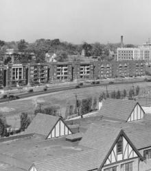
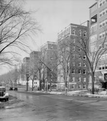
Wide view of the apartment buildings along Mill Creek Parkway. This photograph was taken looking northwest from atop the Ponce de Leon at 4555 Main Street, Kansas City, Missouri.