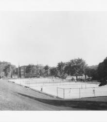
Photograph of people playing tennis at the North Terrace Park tennis courts. This vantage point faces south-southwest from the southwest corner of Gladstone Boulevard and St John Avenue.
Parks
Displaying 13 - 24 of 60
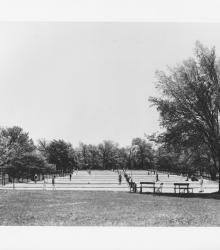
Circa 1930 photograph of the Swope Park tennis courts. This vantage point faces east from near the present intersection of Pavilion Road and Starlight Road.
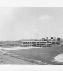
Photograph of the Ford Assembly Plant at the intersection of 10th Street and Winchester Avenue. This vantage point faces northeast on the north side of 12th Street between Ewing Avenue and Winchester Avenue.

Photograph of the rear of the Montgomery Ward building at the northeast corner of St John Avenue and Belmont Boulevard. This vantage point faces south towards the complex from Indian Mound Point (Indian Mound Park).
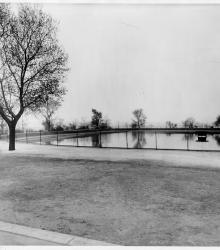
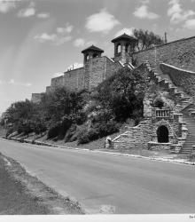
Photograph looking south-southeast towards the Observation Park reservoir.
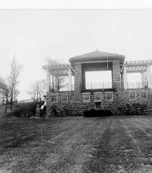
Photograph looking south toward the band stand and comfort station located in Observation Park.
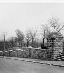
Photograph looking north-northeast towards the west entrance of Observation Park from the northwest corner of Holly Street and 20th Terrace.
Photograph looking north along Kersey Coates Drive near the end of 10th Street. The palisades or cliffs of West Terrace Park are in view.
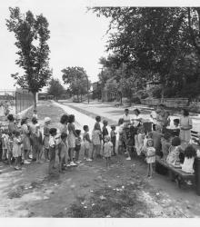
Photograph of participants in the Summer Playground Feeding Program lined up at Mulkey Square Park. This vantage point faces east near the intersection of 13th Street and Belleview Avenue (defunct at this block).
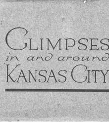
Small book containing prints of Kansas City attractions, including the outside and grand lobby of Union Station, Grand Avenue looking south from 8th Street, Petticoat Lane looking east, the lake and speedway in Penn Valley Park, Armour Boulevard, the entrance and shelter house of Swope Park, Gladstone Boulevard with view of R. A.
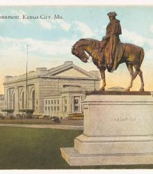
Postcard of the Washington Monument pointing south at its original location near the center of Washington Square Park. This bronze equestrian statue is a replica of one designed by Henry Merwin Shrady for display in Brooklyn, New York. This vantage point faces west towards Union Station in the background.
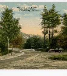
Postcard showing the Santa Fe Trail Marker inside of a roundabout near Broadway and 30th Street in Penn Valley Park, Kansas City, Missouri. This vantage point faces southeast from just north of the roundabout, which is located west of Broadway Boulevard at the intersection 30th Street and Penn Drive.