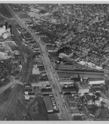
Circa 1930 photograph with an aerial view of Southwest Boulevard looking northeast just east of the state line. Schutte Lumber Company, located at 2931 Southwest Boulevard, is pictured.
Railroad tracks
Displaying 13 - 24 of 25

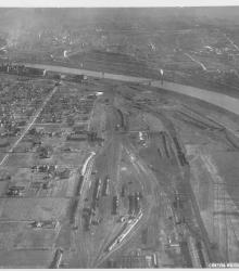
Circa 1930 photograph with an aerial view of a residential area and rail yard with roundhouse near the Kansas River in the Argentine neighborhood. This vantage point faces northwest and shows Armourdale to the right of the river.
Circa 1930 photograph with an aerial view, looking east, across the Armourdale district and towards the Kansas River.
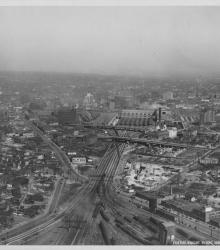
Circa 1930 photograph with an aerial view looking northeast over near 25th Street and Southwest Boulevard; shows the west side of Union Station. Identified on back as "Penn Ave. Viaduct & Union Sta."
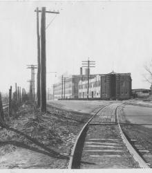
Circa 1925 photograph looking northeast on Independence Road (presently Wilson Avenue) from just west of its intesection with Wheeling Avenue. Pictured is the Burdett Manufacturing Company (left), the Congregation Tefares Israel Jewish Cemetery (left background), and the Kansas City Terminal Railway (right).
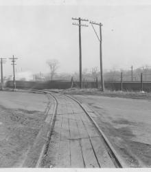
Circa 1925 photograph looking east at the intersection of Independence Road (presently Wilson Avenue) and Wheeling Avenue. Pictured is a train on the Kansas City Terminal Railway.
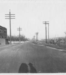
Circa 1925 photograph looking west on Independence Road (presently Wilson Avenue) from just east of its intesection with Wheeling Avenue. Pictured is the Kansas City Terminal Railway (left), and the Huttig Mill Work Company (center).
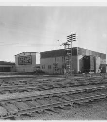
Circa 1930 photograph with frontal and side view of City Ice Company of Kansas City, Plant No. 22, Leeds, built in 1917. It was located between 39th Street to the north, 40th Street to the south, the Missouri Pacific Railroad to west, and Holden Avenue to the east. Holden is a defunct street one block east of Bennington Avenue.
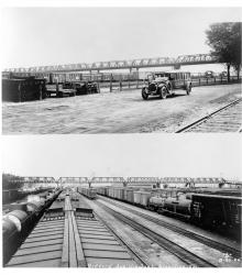
Two photographs of the viaduct at Goddard Viaduct in Kansas City, Kansas. The viaduct, built in 1923, replaced an earlier structure and allowed Goddard Avenue to continue over the rail yards in the Argentine neighborhood.
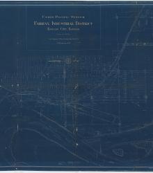
Blueprint map of the Fairfax Industrial District in Kansas City, Kansas, showing Union Pacific Railroad facilities, tracks, and other properties, as well as depicting features of the Missouri and Kansas Rivers and mapping city streets and the rail lines of other companies.
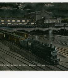
Postcard showing Kansas City Union Station and its train sheds to the west. This vantage point faces southeast towards Union Station from near the defunct intersection of Broadway Boulevard and Milwaukee Avenue (now 22nd Street). The back of the postcard includes a short letter to W. B. Walker of Okmulgee, Oklahoma.
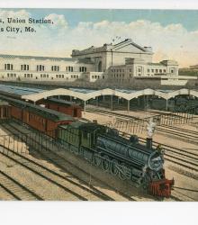
Postcard showing the Kansas City Union Station and its train sheds to the west. This vantage point faces southeast towards Union Station from near the defunct intersection of Broadway Boulevard and Milwaukee Avenue (now 22nd Street). The back of the postcard includes a short letter to Mrs. Harley McCasland of Jefferson City, Missouri.