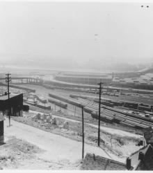
Circa 1930 photograph with slide description, "Looking W. over S. end of W. Bottoms, 23rd St. Viaduct, American Royal, sheep & mule barns: K.
Rivers
Displaying 1 - 12 of 41
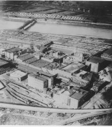
Photograph with slide description, "Air view over Swift's plant to Stock Exchange; Kansas City, Mo. (1927)."
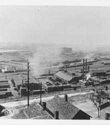
Photograph with slide description, "Over W. Bottoms past Stock Exchange, from 20th and top of bluff; K. C., Mo. (1927)." This vantage point faces northwest from just west of the intersection of 20th Street and Mercier Place.
Photograph with an aerial view of the industrial area looking south along the Blue River. Streets shown include Independence Road (presently Wilson Road) (foreground), Independence Avenue (center), and 12th Street (background). Ford Motor Company (right background) and the American Radiator Company (center background) are also pictured.
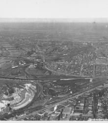
Circa 1930 photograph with an aerial view, looking east, across the Armourdale district and towards the Kansas River.
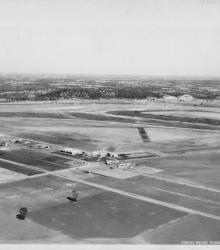
Circa 1930 photograph with an aerial view of Fairfax Industrial Airport in Kansas City, Kansas. It is noted on the back of the photograph that Curtiss Wright is at the northern end of the field. This vantage point faces northeast an shows the intersection of Funston Road and Fairfax Road (presently Fairfax Trafficway) in the center.
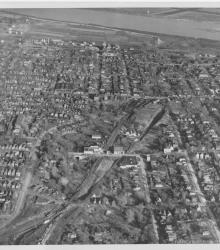
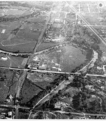
Circa 1930 photograph with an aerial view of northeast Kansas City, Kansas. This vantage point faces east and shows the area that will eventually be remade as Jersey Creek Park.
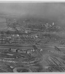
Circa 1930 photograph with an aerial view looking east-northeast across the West Bottoms from Kansas City, Kansas. Includes view of downtown Kansas City, Missouri, as well as the 2nd Hannibal Bridge and the ASB bridge. Both the Kansas and Missouri rivers in view.
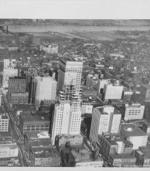
Circa 1930 photograph with an aerial view looking north near 12th Street and Grand Avenue; shows the Bryant Building under construction. Missouri River and riverfront area also in view.
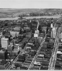
Circa 1930 photograph with an aerial view looking north near 14th and Walnut; shows Kansas City Power and Light and Fidelity National Bank buildings under construction. Both the second Hannibal Bridge and the ASB Bridge are in view as well as the Municipal Airport.
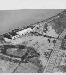
Circa 1930 photograph with an aerial view of the municipal wharf on the east side of state line in Missouri, opposite the airport. This vantage point faces east-northeast with the Missouri River behind the wharf.
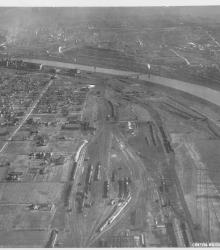
Circa 1930 photograph with an aerial view looking north near 29th Street and Southwest Boulevard. The stockyards, train roundhouse, Kansas River, and Missouri River are pictured.