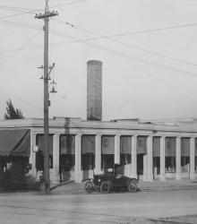
Exterior of Colonial Shops at 51st Street between Brookside Boulevard and Oak Street, showing one automobile parked out front. This vantage point faces northeast at the intersection of Brookside Boulevard and 51st Street.
Streets
Displaying 649 - 660 of 706
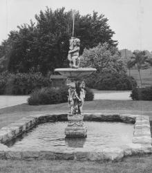
Fountain at Brookwood Road and State Line Road, found by Mr. Nichols while traveling in London. This vantage point faces west on Brookwood Road just west of State Line Road in Mission Hills, Kansas.
This picture of the Country Club Plaza was taken looking northwest on 47th Street between Wornall Road and Central Street.
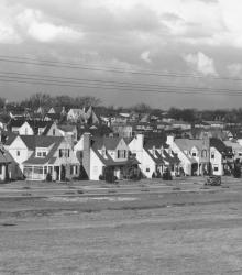
Wide view of Oak Meyer Gardens housing development. This vantage point faces northwest from 69th Street and Holmes Road. Cherry Street north of 69th Street is pictured in foreground; the steeple of Sixth Church of Christ Scientist and Southwest High School on Wornall Road is pictured in the right far background.
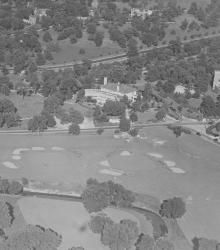
An aerial view of the Mission Hills Country Club showing the completed club house, with State Line Road running across the center of the picture. After the Mission Hills Country Club moved across the border to Kansas, the building pictured center became part of the Carriage Club.
This aerial photograph of the Country Club Plaza was taken near Oak Street just south of 47th Street (now Emanuel Cleaver II Boulevard).
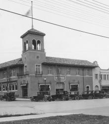
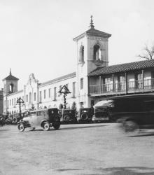
This picture of the Tower Building and Wolferman Building was taken looking north-east at the intersection of 47th Street and Wyandotte Street.
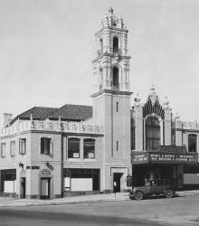
This picture of the Country Club Plaza Theater was taken looking west-northwest at the intersection of Alameda Road (now Nichols Road) and Wyandotte Street.
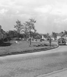
Around the corner view of a neighborhood found in the then-new Fairway housing development. The name was chosen because of the development's proximity to three golf courses. This vantage point faces south down Fairway Road from the intersection of U.S. Route 50 (now Shawnee Mission Parkway) and Fairway Road.
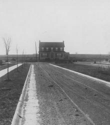
Three homes on 61st street at the end of the completed Belleview Avenue. This vantage point faces south on Belleview Avenue from just south of Huntington Road.
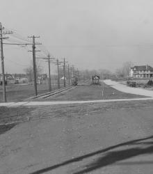
This picture was taken looking north at the southwest corner of Brookside Road and 66th Terrace. Wornall Road at the left.
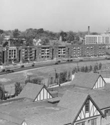
Wide view of the apartment buildings along Mill Creek Parkway. This photograph was taken looking northwest from atop the Ponce de Leon at 4555 Main Street, Kansas City, Missouri.