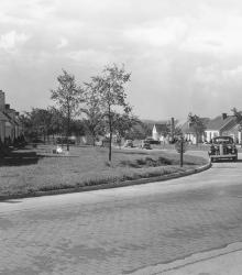
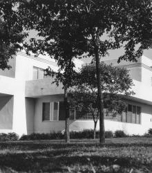
Around the corner view of a neighborhood found in the then-new Fairway housing development. The name was chosen because of the development's proximity to three golf courses. This vantage point faces south down Fairway Road from the intersection of U.S. Route 50 (now Shawnee Mission Parkway) and Fairway Road.
Trees
Displaying 37 - 48 of 231
An early picture of the Mission Hills Country Club House, once located in Kansas City, Missouri. After the Mission Hills Country Club moved across the border to Kansas, the building pictured became part of the Carriage Club. This vantage point faces southeast on State Line Road just south of Brush Creek.
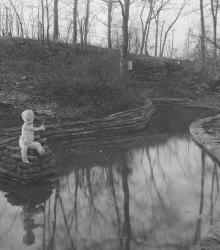
The statue of a small boy and a pool were features of the Crestwood interior park named Happy Woods Park, once located between 54th Street, 55th Street, Locust Street, and Cherry Street. This vantage point faces southeast towards the intersection of Locust Street, 55th Street, and Oak Street in the far right background.
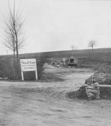
Sign for Wornall Manor, looking southwest from the intersection of Pennsylvania Avenue, Valley Road, and 62nd Street.
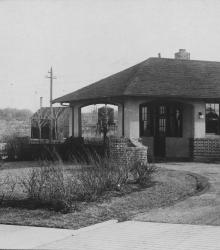
Standard Oil Company Filling Station planned, designed and constructed by the J. C. Nichols Company for the Standard Oil Company. This vantage point faces northeast on Brookside Boulevard just south of 62nd Terrace.
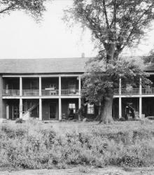
The restored dormitory building of the Shawnee Indian Mission. This building is located at the northeastern corner of 52nd Street and Porter Road (now 53rd Street and Mission Road). This vantage point faces north on present day 53rd Street from just east of Mission Road.
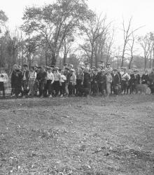
Saturday morning cross country hikes for the boys of the Country Club District, arranged by Miss Louise Hook, Community Secretary.
Home of Edwin W. Shields at 5110 Cherry Street, completed shortly after World War I. This vantage point faces south-southeast towards the main entrance of the home. This building is now part of the University of Missouri - Kansas City.
In June 1936, the J. C. Nichols Company built this home at 6505 State Line Road for W. Edwin Bixby, president of the Kansas City Life Insurance Company. This vantage point faces south-southeast towards the house from just east of State Line Road.
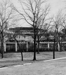
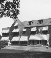
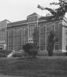
Exterior of the Administration Building of the Country Day School, later called Pembroke Country Day School. It was once located near the southeastern corner of 51st Street and State Line Road. The ground on which this building stood is now the quadrangle of the Pembroke Hill School - Ward Parkway Campus.
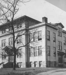
Northern exterior of E. C. White School, first public school in the Country Club District, once located at the northwest corner of 49th and Main Streets. This vantage point faces southeast on a portion of Brookside Boulevard now renamed Ward Parkway, just west of Main Street.
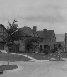
Some of the earlier homes built in Armour Hills, this block of homes is part of the Edgevale Road group. The spectators in the photograph include Grace Carlson and Ernest Holt. This vantage point faces northeast from just south of the intersection of 65th Terrace and Edgevale Road.