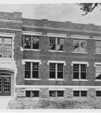
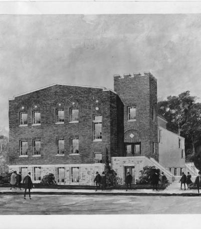
Photograph with exterior view of the parochial school for the First Presbyterian Church of Independence, Missouri, located at the northwest corner
Communities and Neighborhoods
Image Gallery

Photograph of Strang Line interurban railway conductor Leonidas "Lon" Cave, wearing his conductor's uniform, standing on the sidewalk in front of a
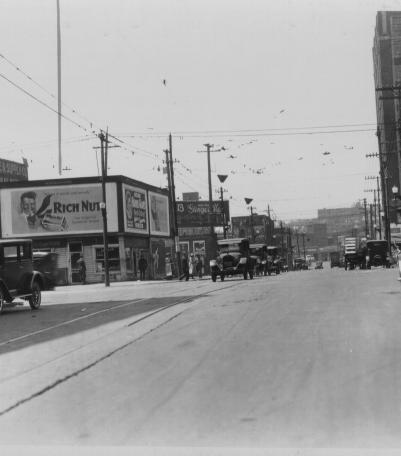
This photograph was taken looking west on 19th Street just east of Grand Avenue.

Photograph with view of large, obelisk tombstone with the name "Armstrong" engraved on it located in Huron Cemetery in downtown Kansas Ci
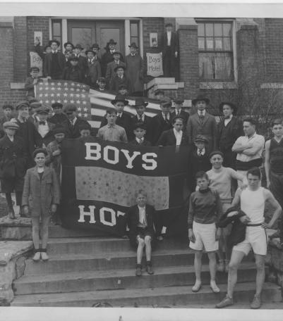
Photograph of boys and men posed with a "Boys Hotel" banner on the steps of the Boys Hotel Main Building at the southeast corner of Admir
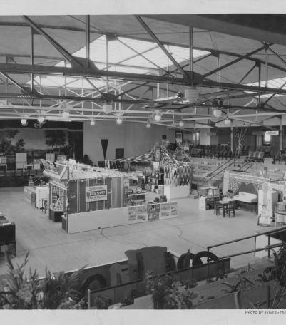
Photograph of Johnson County Fair exhibit booths and demonstrations in the Shawnee Mission Rural High School gymnasium in 1931.
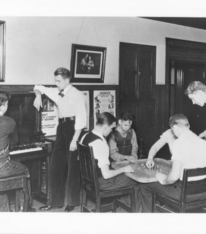
Photograph of seven young men in the recreation room and lobby of the Boy's Hotel and Boy's Club.
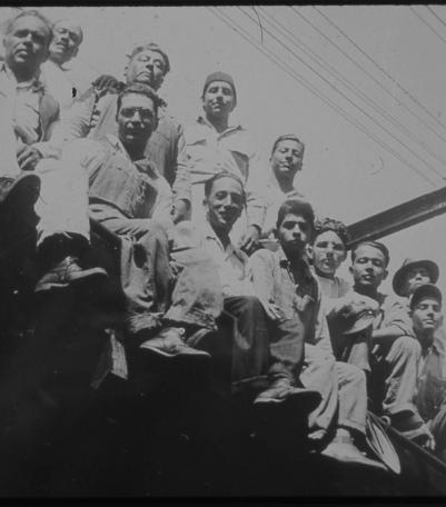
Undated photograph of unidentified children and teenagers from the Mexican community in Kansas City, Kansas.
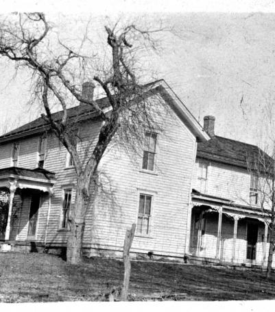
Photograph of the Perry Cross home, located at 4806 Highway 50, near the Shawnee Indian Mission area circa 1925.
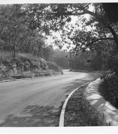
Image of Golf Course Road in Swope Park, Kansas City, Missouri, ca. 1930s.
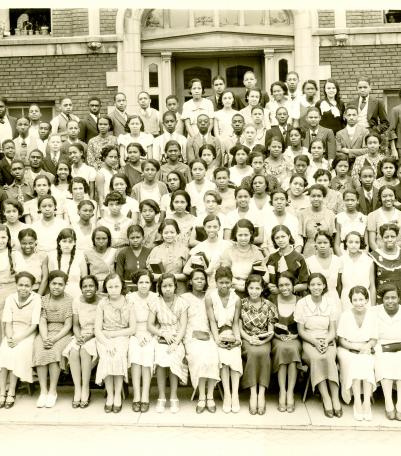
Photograph of the Lincoln High School Class of 1933 posed outside of the main entrance to the school.
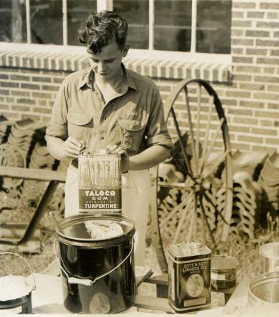
Photograph of Dan Porterfield, a Future Farmers of America participant, preparing paint outside Shawnee Mission Rural High School in 1940 or 1941.
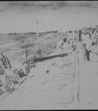
Undated photograph of unidentified railroad workers in Kansas City, Kansas.
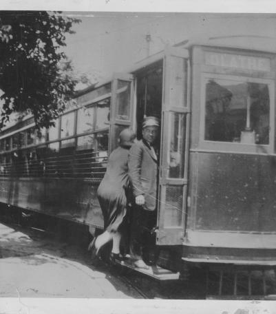
Photograph of a woman boarding a Strang Line train, with a motorman standing on a step looking to the right, circa 1930.
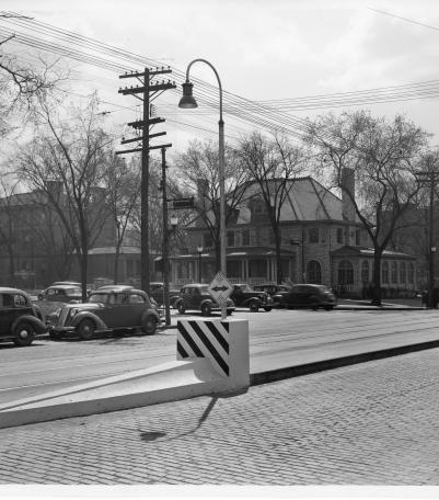
Photograph of "streamlined" Safety Zones intended to protect patrons at streetcar stops, Kansas City, Missouri, ca. 1930s.