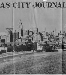
Clipping from the Kansas City Journal-Post on September 29, 1935 showing downtown Kansas City. This vantage point faces north-northwest from the east side of Gillham Road between 23rd Street and 24th Street. The photograph shows the Kansas City Journal-Post Building (left-center) and the Western Auto Building (left).
Crossroads
Displaying 61 - 72 of 134
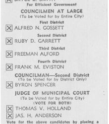
Small card to be used by voters in the second district to instruct them which candidates to vote for in the municipal election on Tuesday, March 27, 1934. The document was issued by the Jackson County Democratic Organization.
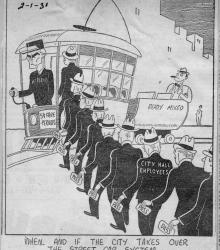
Clipping from the Kansas City Star on February 1, 1931 showing city hall employees with free passes getting onto a street car driven by Henry F. McElroy. A "Ready Mixed" cart is being pulled behind the street car.
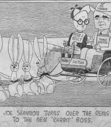
Clipping from the Kansas City Star on February 1, 1931 showing Joe Shannon turning over the reins to a rabbit drawn carriage of the "Rabbit Faction" to Peter J. Kelly. Dr. L. C. "Doc" Johnson is shown walking away in the background.
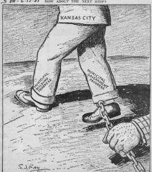
Clipping from the Kansas City Star on June 12, 1931 showing corruption holding back "Municipal Building Progress" and "Municipal Government Progress" in Kansas City.
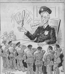
Clipping from the Kansas City Star on March 16, 1932 showing the Kansas City Police Department saluting Henry F. McElroy.
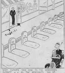
Clipping from the Kansas City Star on March 22, 1931 showing graves where street parking should be in downtown Kansas City.

Photograph of a crowd assembled for a Labor Day parade at the corner of 16th Street and Cherry Street in Kansas City, Missouri. This vantage point faces east-southeast from the northwest corner of 16th and Cherry with the Fred Hacker Plumbing and Heating Building in the left background at 617 East 16th Street.
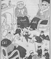
Clipping from the Kansas City Star of Tom Pendergast, Joe Shannon, and Cas Welch dressed as old women and knitting while the Kansas City Police Department plays like children on the floor. The signs on the wall show, "God Bless Our Home", "Crime never pays", and "The way of the transgressor is hard".
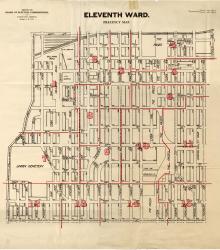
Map showing the boundaries of precincts as defined in 1918 for the eleventh ward of Kansas City, Missouri. This ward is bounded by 20th Street to the north, Grand Avenue (now Grand Boulevard) to the west, 31st Street to the south, and Michigan Avenue to the east.
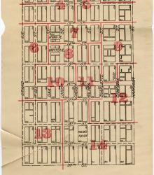
Map showing the boundaries of precincts as defined in 1918 for the sixth ward of Kansas City, Missouri. This ward is bounded by 9th Street to the north, Grand Avenue (now Grand Boulevard) to the west, 20th Street to the south, and Harrison Street to the east.
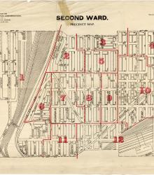
Map showing the boundaries of precincts as defined in 1918 for the second ward of Kansas City, Missouri. This ward is bounded by 14th Street to the north, Kansas to the west, 24th Street to the south, and Grand Avenue (now Grand Boulevard) to the east.