Circa 1930 photograph with an aerial view looking southeast over the Intercity Viaduct and northern part of West Bottoms. Distant view of downtown Kansas City in the top with Quality Hill area and 8th Street Tunnel entrance.
West
Displaying 97 - 108 of 396
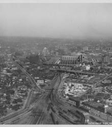
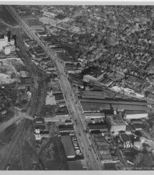
Circa 1930 photograph with an aerial view looking northeast over near 25th Street and Southwest Boulevard; shows the west side of Union Station. Identified on back as "Penn Ave. Viaduct & Union Sta."
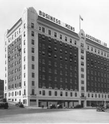
Photograph with full frontal view of Business Men's Assurance Co. building on Pershing Road, the former Sweeney School for auto, tractor, and aviation. Park Hotel is visible in background. This vantage point faces south-southwest on Pershing Road from just south of Union Station.
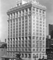
Photograph with full frontal and side view of Kansas City Club building looking northwest from 13th Street and Baltimore Avenue. A small gas station is visible on the south side of 13th Street.
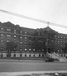
Circa 1932 photograph with view of the old Saint Mary's Hospital, 2800 Main Street, looking west.
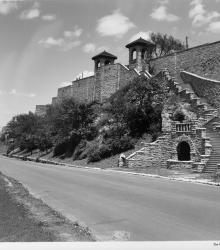
Photograph looking north along Kersey Coates Drive near the end of 10th Street. The palisades or cliffs of West Terrace Park are in view.

Photograph looking north up Baltimore Avenue from near 16th Street. The Kansas City Power and Light Building is in full view in the center of the photograph. The sign for the President Hotel is also in view on the right.
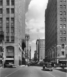
Photograph of Baltimore Avenue looking north from 14th Street. The description on the back of the photograph reads: "Balt. Ave. looking north from 14th St. Bldg on left [background] is the K.C. Club bldg. and on the right [background] is Kansas City's largest retail furniture store, the Robt.
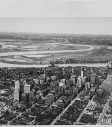
Circa 1930 photograph with an aerial view of downtown Kansas City looking northwest, taken over near 15th Street and Grand Avenue. Shows Missouri River, Municipal Airport, 2nd Hannibal Bridge, and ASB Bridge.
Circa 1930 photograph with an aerial view of Southwest Boulevard looking northeast just east of the state line. Schutte Lumber Company, located at 2931 Southwest Boulevard, is pictured.
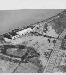
Circa 1930 photograph with an aerial view of the municipal wharf on the east side of state line in Missouri, opposite the airport. This vantage point faces east-northeast with the Missouri River behind the wharf.
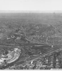
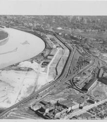
Circa 1930 photograph with an aerial view looking north near 29th Street and Southwest Boulevard. The stockyards, train roundhouse, Kansas River, and Missouri River are pictured.