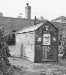
Halloween decorations on the Plaza, showing the shack of the Plaza Witch who would read your future for free. This picture was taken looking south at the southwest corner of Alameda Road and Central Street. This shack was located at the future site of the Plaza Medical Building. The J. C. Nichols Company Building is shown in the background.
Westport
Displaying 361 - 372 of 515
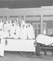
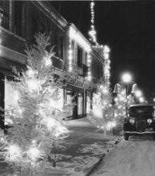
Groups of carolers traveled around the Country Club District on Christmas Eve. The J. C. Nichols Company furnished the hayracks and teams of carolers. This vantage point faces north towards the Country Club Coffee Shop at the Colonial Shops on 51st Street between Brookside Boulevard and Oak Street.
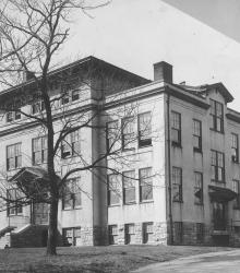
Exterior of the Administration Building of the Country Day School, later called Pembroke Country Day School. It was once located near the southeastern corner of 51st Street and State Line Road. The ground on which this building stood is now the quadrangle of the Pembroke Hill School - Ward Parkway Campus.
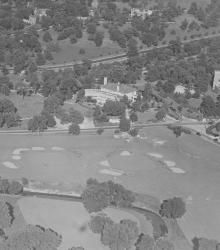
An aerial view of the Mission Hills Country Club showing the completed club house, with State Line Road running across the center of the picture. After the Mission Hills Country Club moved across the border to Kansas, the building pictured center became part of the Carriage Club.
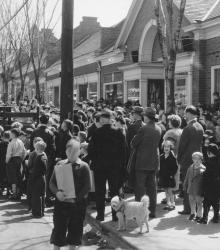
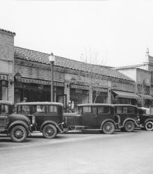
This picture of the Crestwood Shops was taken looking east-southeast on 55th Street between Brookside Boulevard and Oak Street. A crowd of men, women, and children are waiting to see the Easter Bunny.
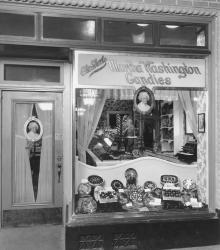
Martha Washington Candy Shop located at 215 West 47th Street. This vantage point faces south on 47th Street between Wyandotte Street and Central Street.
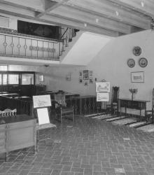
First floor lobby of the J. C. Nichols Companies building at 310 Ward Parkway, Kansas City, Missouri.
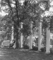
Six white columns stand erect in a park at Locust Street and Cherry Street, the structure patterned after the columns on the campus at the University of Missouri. This vantage point faces southeast at the intersection of Locust and Cherry, one block north of 54th Street.
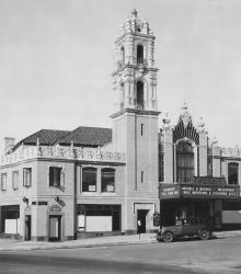
This picture of the Country Club Plaza Theater was taken looking west-northwest at the intersection of Alameda Road (now Nichols Road) and Wyandotte Street.
This picture of the J. C. Nichols Company building was taken looking northeast on the north side of Ward Parkway just west of Central Street.
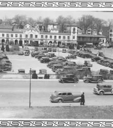
This picture was taken looking north from atop the J. C. Nichols Building, between Broadway and Central Street, Alameda Road and Ward Parkway. The parking lot was located between Broadway and Central Street, Alameda Road and 47th Street. The Plaza Balcony Building is shown in background.
This picture was taken looking northeast on the Ward Parkway just east of Pennsylvania Avenue.