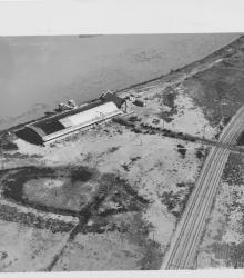
Circa 1930 photograph with an aerial view of the municipal wharf on the east side of state line in Missouri, opposite the airport. This vantage point faces east-northeast with the Missouri River behind the wharf.
Rivers
Displaying 13 - 24 of 41
Circa 1930 photograph with an aerial view looking north near 29th Street and Southwest Boulevard. The stockyards, train roundhouse, Kansas River, and Missouri River are pictured.
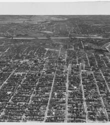
Circa 1930 photograph with an aerial view of the downtown Kansas City area, looking west centered over near 12th and Troost. Includes view of West Bottoms and the Kansas River. Covers around 3rd Street south to near 18th Street.
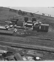
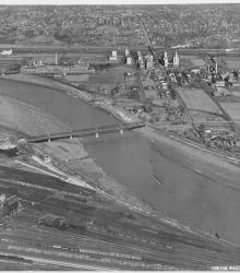
Circa 1930 photograph with an aerial view of the Corn Products Refining Company near the intersection of 10th Avenue and Bedford Avenue in North Kansas City, Missouri. This vantage point faces southeast and shows the Missouri River (background) and the Kansas City Car Company (left foreground).
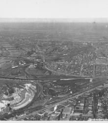
Circa 1930 photograph with an aerial view looking southeast over the Intercity Viaduct and northern part of West Bottoms. Distant view of downtown Kansas City in the top with Quality Hill area and 8th Street Tunnel entrance.
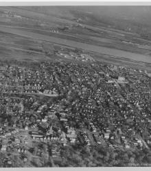
Circa 1930 photograph with an aerial view looking east and showing a largely residential section of northeast Kansas City, Kansas; Fairfax; Missouri River; and North Kansas City, Missouri. Quindaro Boulevard is prominently shown diagonally in the photograph.
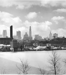
Photograph with view of the downtown skyline from just north of the Missouri River.
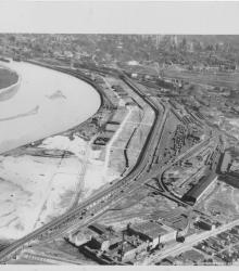
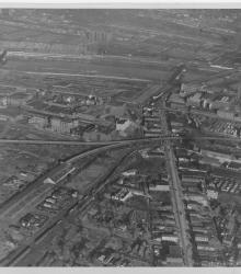
Circa 1930 photograph with an aerial view looking north showing West Bottoms and stockyard area. Kansas River and bridges in view. Missouri River in distance on top and 12th Street Viaduct is visible.

Circa 1920 photograph with aerial view of New Richards Field which soon became known as Municipal Airport. Hannibal Bridge is pictured in the background.
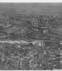
Circa 1930 photograph with an aerial view of the Kansas River looking north and showing the neighborhoods Argentine (left), Armourdale (right), Kensington (left background), and Riverview (right background). The Proctor and Gamble plant is also pictured.
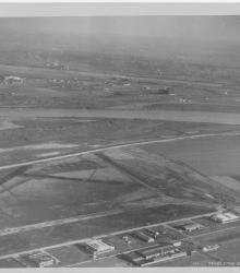
Circa 1930 photograph with an aerial view, looking east, of Fairfax Industrial and Municipal airports.
Circa 1930 photograph with an aerial view looking east across the Kansas River near west end of the Kansas Avenue Bridge; shows Cudahy Packing Company, Swift and Company, and the Kansas City Stockyards.