Photograph of the Webster School located at the northwest corner of Wyandotte Street and 17th Street. The school opened in 1886 and closed in 1933. It was named after statesman Daniel Webster. This vantage point faces northwest from the northeast corner of 17th and Wyandotte.
Streets
Displaying 85 - 96 of 706
Photograph of original Paseo High School, once located on the east side of Flora Avenue between 47th Street Terrace (Houston Avenue) and 48th Street Terrace. This vantage point faces southeast on the west side of Flora just south of 47th Street Terrace.
Grouping of four exterior snapshots of students with teachers on Kensington School lawn. All photographs except the top center picture were taken outside of the south facing southeast entrance to the school.
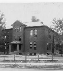
Photograph with a full exterior, street level view of Manchester School, once located at the southwest corner of Winchester Avenue and 15th Street (Truman Road). This vantage point faces southwest from the northwest corner of 15th and Winchester.
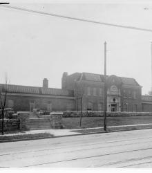
Photograph of the Westport Junior High School located at the northeast corner of 39th Street and McGee Street. This vantage point faces north-northeast from the southwest corner of 39th and McGee.
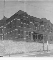
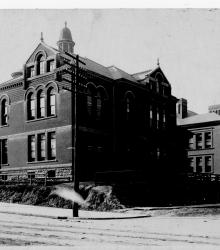
Photograph with full, exterior street level view of "Madison School for the Deaf & Dumb", once located at the northeast corner of 29th Street and Wyandotte Street. It was named after U.S. President James Madison.
Photograph with full, street level, corner view of the Irving School located on the south side of 24th Street between Wabash Avenue and Prospect Avenue. The school was later named for Booker T. Washington. This vantage point faces southwest from the northeast corner of Prospect and 24th.
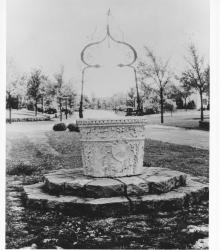
Photograph with slide description: "Venetian well head; 61st and State Line; Kansas City, MIssouri. (1931)." This vantage point faces east between Huntington Road and 61st Street just east of State Line Road.
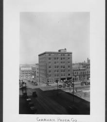
Circa 1928 photograph with full frontal and side view of the Graham Paper Company, once located at the northeast corner of 6th Street and Broadway Boulevard. Other businesses in view include Kansas City Furnace Company and Sleek-Warwick Paper Company.
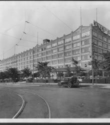
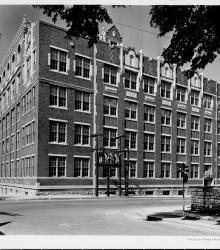
Circa 1928 photograph with frontal and side view of the Montgomery Ward's building, located on the northeast corner of Belmont Boulevard and Saint John Avenue.
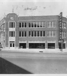
Circa 1928 photograph with full frontal and side view of the Studebaker Riley Company, located at the southwest corner of 26th Street and Grand Avenue. This vantage point faces west from the northeast corner of 26th and Grand.
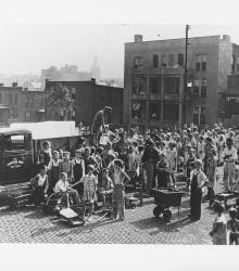
Photograph with slide description: "Selling ice from Salvation Army Penny Ice truck, K.C., Mo." This vantage point faces northeast from the northwest corner of 13th Street and Summit Street.