
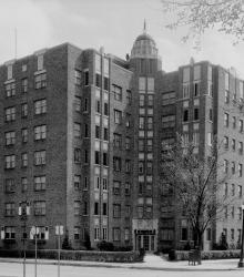
Photograph of the Park Lane Apartments, located on the west side of Mill Creek Parkway (presently J C Nichols Parkway) between just north of 46th Street Terrace.
Plaza
Displaying 1 - 12 of 103
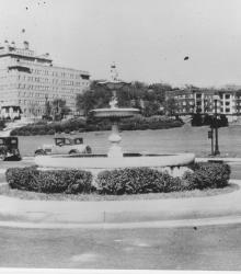
Photograph looking northeast with slide description: "Venetian fountain, 47th and Mill Creek; Kansas City, Mo. (1931)."
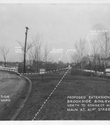
Photograph with caption, "proposed extension of Brookside Boulevard north to connect with Main at 41st Street." At the time, Brookside Boulevard was to be extended north until 41st Street were it would meet with Main Street. The Country Club Car Line, Ponce de Leon Hotel, 47th Street, St.
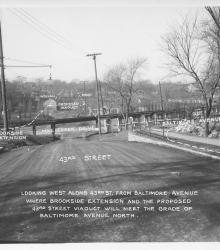
Photograph with caption, "looking west along 43rd St. from Baltimore Avenue where Brookside Extension and the proposed 43rd Street Viaduct will meet the grade of Baltimore Avenue north." The photograph's annotations label streets and show proposed road improvements.
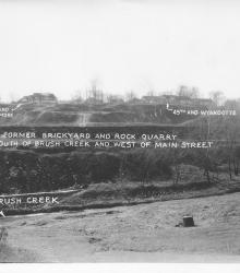
Photograph with caption, "The former brickyard and rock quarry south of Brush Creek and west of Main Street." This vantage point faces south from near the intersection of Wyandotte Street and Ward Parkway and shows annotations labeling Brush Creek and street intersections.
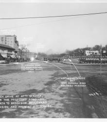
Photograph with caption, "Mill Creek Drive at 47th Street, showing the proposed roadway due north to Brookside Boulevard Extension and main at 41st Street. Plaza shops, Park Lane Hotel, and St. Luke's Hospital are pictured.
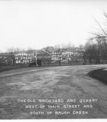
Photograph with caption, "The old brickyard and quarry west of Main Street and south of Brush Creek." This vantage point faces south on Baltimore just north of its intersection with Ward Parkway. The photograph's annotations label street intersections and show proposed road improvements.
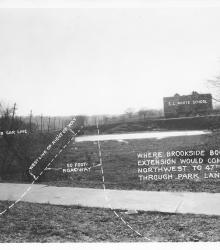
Photograph with caption, "where Brookside Boulevard Extension would come northwest to 47th Street through Park Land." This vantage point faces south from just south of the intersection of Main Sreet and 47th Street.
Photograph of the Mark Twain Apartment building located at the southeast corner of 48th Street and Roanoke Parkway.
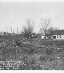
Photograph with caption, "looking north from Park Land at 48th Street and Country Club Car Line, showing approach of proposed trafficway to widened east 48th Street." Park Lane Hotel, St. Luke's Hospital, and Ponce De Leon Hotel, and three unidentified children are pictured.
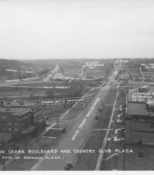
Photograph with caption, "Brush Creek Boulevard and Country Club Plaza [looking west] from roof of Sophian Plaza." The annotations on the photogaph label streets and show proposed road improvements.
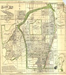
Map of "The Country Club District including Sunset Hill, Mission Hills, Hampstead Gardens, Wornall Manor, Greenway Fields, '1,500 Acres Restricted', Planned, Developed and Offered Exclusively by J. C.