
View of Arbor Villa Park. Homes, cherubs, trees, a tennis court, and playground equipment all visible in background. This vantage point faces south towards the intersection of Edgevale Road and Main Street in the right background.
Houses
Displaying 121 - 132 of 272
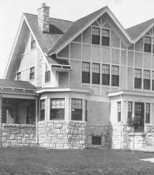
5434 Central Street home of Zeno T. Briggs, who bought a lot in 1909 and lived at this home until June 1929. This vantage point faces west-northwest on Central Street just north of 55th Street.
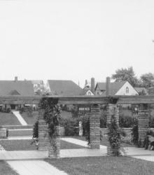
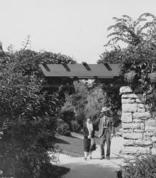
This picture of Arbor Villa Park was taken looking south-southeast at the intersection of 66th Terrace and Main Street. A man and a woman stand near the pergola in Arbor Villa Park.
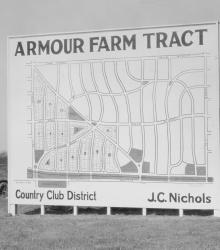
Men and women gaze at a J. C. Nichols Company sign showing available plots for sale in Armour Farm development.
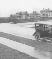
Looking west at 61st Terrace and Summit Street. In the foreground is an automobile, and in the background is a row of houses.
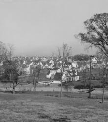
Wide view of the then-newest member of Country Club District, Fairway. The name was chosen because of the development's proximity to three golf courses. This vantage point faces northeast towards State Park Road between Canterbury Road and Falmouth Road from near the northern limits of the Kansas City Country Club.
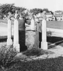
Romanelli Gardens, the northeast portion of the Armour Farm, just west of Wornall Road and south of 67th Street, has been added to the developing section of the Country Club District. This vantage point faces north-northeast at the intersection of Pennsylvania Avenue and 68th Terrace were this fountain was once located.
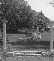
Two young women sitting near a lamp sculpture with a house at 5939 Overhill Road barely visible in the background. This vantage point faces northeast towards the small park at the intersection of Stratford Road and Oakwood Road, in Mission Hills, Kansas.
Three homes on 61st street at the end of the completed Belleview Avenue. This vantage point faces south on Belleview Avenue from just south of Huntington Road.
Two residents, a man and a woman, of Greenway Fields walk near the Rams' Heads, a decorative motif for a trellis over the sidewalk on Valley Road near 62nd Street. This vantage point faces north-northeast on Valley Road south of 62nd Street.
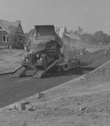
J. C. Nichols Companies Field Construction Department trucks paving the middle of the street in the Armour Hills Gardens housing development.

A young boy with his bike and dog photographed in front of a Slow - Children street sign erected by the Westwood Homes Association at Westwood Road and Mercier. This vantage point faces north-northwest at the intersection of Mercier Street and Westwood Road.