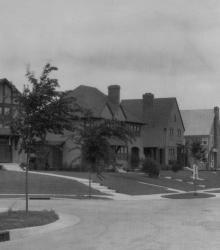
Some of the earlier homes built in Armour Hills, this block of homes is part of the Edgevale Road group. The spectators in the photograph include Grace Carlson and Ernest Holt. This vantage point faces northeast from just south of the intersection of 65th Terrace and Edgevale Road.
Houses
Displaying 109 - 120 of 272
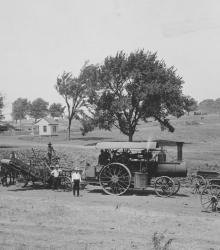
Men, mules, and machines constructing the Country Club District.
In June 1936, the J. C. Nichols Company built this home at 6505 State Line Road for W. Edwin Bixby, president of the Kansas City Life Insurance Company. This vantage point faces south-southeast towards the house from just east of State Line Road.
Home of Jackson County Democratic Party boss, Thomas J. Pendergast, at 5650 Ward Parkway, built by the J. C. Nichols Company. This vantage point faces west on Ward Parkway, just north of 57th Street.
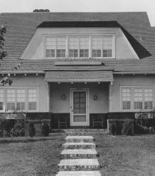
Home of Chester C. Smith at 6418 Washington Street. Smith was later president of the Kansas City Power & Light Company (1330 Baltimore Avenue) during the company strike in 1941. This vantage point faces west on Washington Street.
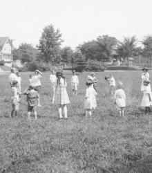
Children playing at a playground at 58th Street and Brookside Boulevard in 1920. This vantage point faces north from near the center of Brookside Triangle Park.

View of Arbor Villa Park. Homes, cherubs, trees, a tennis court, and playground equipment all visible in background. This vantage point faces south towards the intersection of Edgevale Road and Main Street in the right background.
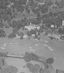
An aerial view of the Mission Hills Country Club showing the completed club house, with State Line Road running across the center of the picture. After the Mission Hills Country Club moved across the border to Kansas, the building pictured center became part of the Carriage Club.
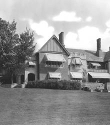
Home of Albert R. Jones at 5701 Mission Drive. This vantage point faces east-southeast on the grounds of the estate towards the front entrance facing Mission Drive.
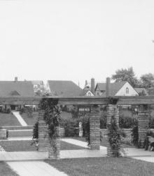
This picture of Arbor Villa Park was taken looking south-southeast at the intersection of 66th Terrace and Main Street. A man and a woman stand near the pergola in Arbor Villa Park.
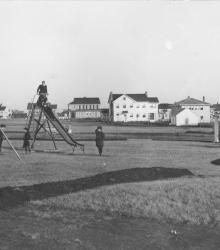
This picture was taken looking north-northeast at the southern tip of Wornall Manor playground, once located in the interior of block six, between 62nd and 63rd Streets, Valley Road and Summit Streets. Several children are shown playing on playground equipment while adults watch from a distance.
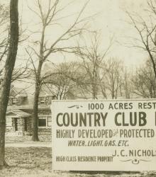
An early J. C. Nichols Company sign located on Brookside Boulevard by Countryside Park. In the background is the "Rock House" located at 5230 Brookside Boulevard. This vantage point faces west on Brookside Boulevard between 52nd Street and 53rd Street.