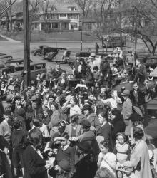
This picture was taken looking west-northwest on 55th Street between Brookside Boulevard and Oak Street. Large crowd of men, women, and children at Crestwood Shopping District on Easter 1935.
Houses
Displaying 97 - 108 of 272
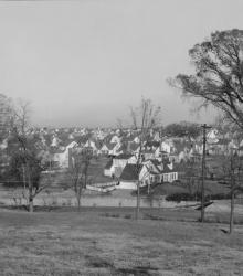
Wide view of Oak Meyer Gardens housing development. This vantage point faces northwest from 69th Street and Holmes Road. Cherry Street north of 69th Street is pictured in foreground; the steeple of Sixth Church of Christ Scientist and Southwest High School on Wornall Road is pictured in the right far background.
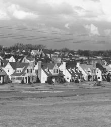
Wide view of the then-newest member of Country Club District, Fairway. The name was chosen because of the development's proximity to three golf courses. This vantage point faces northeast towards State Park Road between Canterbury Road and Falmouth Road from near the northern limits of the Kansas City Country Club.
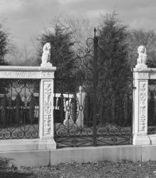
Close exterior shot of the marble balustrade once located at the intersection of Ward Parkway and Meyer Boulevard. This vantage point likely faces north-northeast from the northern curve of Meyer Circle at the intersection of Ward Parkway and Meyer Boulevard
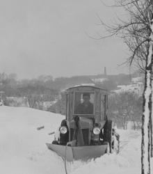
Motorized snowplows are called into action to clear the sidewalks of J. C. Nichols Companies homes in the Oak Meyer Gardens subdivision. This vantage point faces west on 65th Street just west of Cherry Street. Southwest High School at Wornall Road and 65th Street can be seen in the far background.
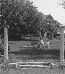
Two young women sitting near a lamp sculpture with a house at 5939 Overhill Road barely visible in the background. This vantage point faces northeast towards the small park at the intersection of Stratford Road and Oakwood Road, in Mission Hills, Kansas.
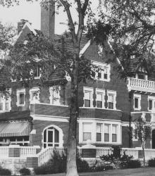
Entrance to 5110 Cherry Street, located in Southwood Park. The home belonged to Edwin W. Shields and construction was completed shortly after World War I. This vantage point faces west on Cherry Street between 51st Street and 52nd Street. This building is now part of the University of Missouri - Kansas City.
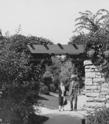
Two residents, a man and a woman, of Greenway Fields walk near the Rams' Heads, a decorative motif for a trellis over the sidewalk on Valley Road near 62nd Street. This vantage point faces north-northeast on Valley Road south of 62nd Street.
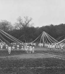
Younger boys and girls participating in maypole dance at the 1923 Field Day on the grounds of the Pembroke-Country Day School. This vantage point faces east-northeast towards houses on Sunset Hill in the far right background.

A young boy with his bike and dog photographed in front of a Slow - Children street sign erected by the Westwood Homes Association at Westwood Road and Mercier. This vantage point faces north-northwest at the intersection of Mercier Street and Westwood Road.
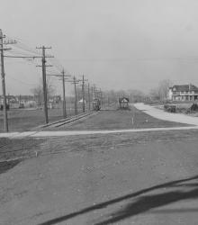
This picture was taken looking north at the southwest corner of Brookside Road and 66th Terrace. Wornall Road at the left.
Home built by Edward Dickinson at 810 W. 52nd Street, and then resided in by Mr. and Mrs. Louis Schutte. This vantage point faces northeast from east of Belleview Avenue and north of 52nd Street.