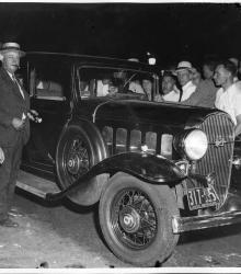
Photograph of a crowd gathered around a Buick automobile on Armour Boulevard. The car belonged to mobster Gus "Steinie" Fasone and was the intended getaway vehicle following the murder of bootlegger Ferris Anthon by Charles Gargotta and accomplices. Fasone and fellow gangster Sam Scola were killed in the exhange by Sheriff Tom Bash.
Westport
Displaying 37 - 48 of 515
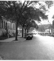
Photograph looking west toward Troost Avenue from the southeast corner of Armour Boulevard and Forest Avenue. The scene was part of an investigation that took place following the August 12, 1933 murder of bootlegger Ferris Anthon by mobster Charles (Mad Dog) Gargotta and others. Sheriff Tom Bash killed two gangsters during the exchange.
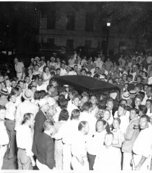
Photograph of a large crowd surrounding a car at Armour Boulevard and Forest Avenue. The car belonged to mobster Gus "Steinie" Fasone and was the intended getaway vehicle following the murder of bootlegger Ferris Anthon by Charles Gargotta and accomplices.
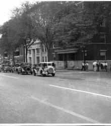
Photograph looking northwest from the southeast corner of Armour Boulevard and Forest Avenue. The scene is part of investigation that took place following the August 12, 1933, murder of bootlegger Ferris Anthon by mobster Charles (Mad Dog) Gargotta and others. Sheriff Tom Bash killed to gangsters during the exchange.
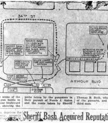
Map of the shootout between police and gangsters on the morning of August 12, 1933. The caption states, "A diagram of the scene of the Saturday morning gun battle in the vicinity of Amour boulevard and Forest avenue, showing the paths taken by the gangsters in their pursuit of Ferris J. Anton and the route taken by Sheriff Thomas B.
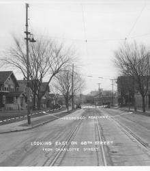
Photograph with caption, "looking east on 48th Street from Charlotte Street." The photograph's annotations label streets and show proposed road improvements.
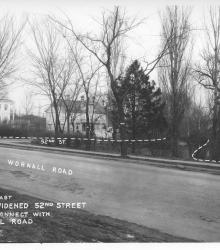
Photograph with caption, "looking east where widened 52nd Street would connect with Wornall Road." The photograph's annotations label streets and show proposed road improvements.
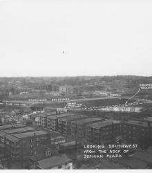
Photograph with caption, "looking southwest from the roof of Sophian Plaza" at the northwest corner of Warwick Boulevard and Brush Creek Boulevard (presently Emanuel Cleaver II Boulevard). The Country Club Car Line and E.C. White School (center background) are pictured.
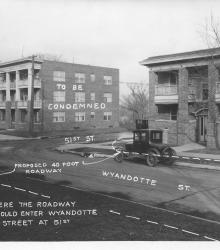
Photograph with caption, "Where the roadway would enter Wyandotte Street at 51st." This vantage point faces northeast from near the intesection of Wyandotte and 51st. The photograph's annotations label streets and show proposed road improvements.
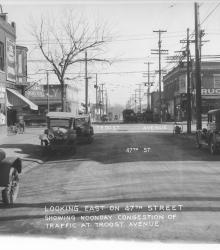
Photograph with caption, "looking east on 47th Street showing noonday congestion of traffic at Troost Avenue." Piggly Wiggly and Crown Drug Co. are pictured.
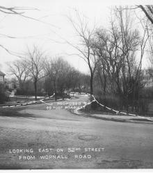
Photograph with caption, "looking east on 52nd Street from Wornall Road." The photograph's annotations show proposed road improvements.
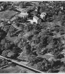
Circa 1930 photograph with an aerial view looking northeast at the intersection of Ward Parkway and State Line Road, showing the campus of Pembroke Country Day School and Brush Creek.