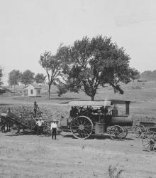
Men, mules, and machines constructing the Country Club District.
The State Historical Society of Missouri-Kansas City
Displaying 121 - 132 of 287
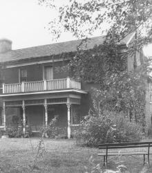
The restored residence of the missionary at the Shawnee Indian Mission. This building is located at the southeastern corner of 52nd Street and Porter Road (now 53rd Street and Mission Road). This vantage point faces southeast on present day 53rd Street from just east of mission Road.
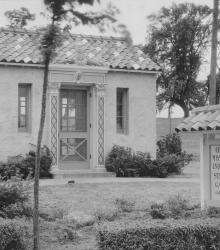
In 1925, the J. C. Nichols Company maintained a small sales office in the Stratford Gardens area located at the southeast corner of 61st Street and State Line Road.
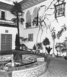
Interior of the Spanish-inspired Country Club Plaza Theater. The theater is bounded by 47th Street and the Alameda Road (now Nichols Road), Wyandotte Street, and Central Street.
An early picture of the Mission Hills Country Club House, once located in Kansas City, Missouri. After the Mission Hills Country Club moved across the border to Kansas, the building pictured became part of the Carriage Club. This vantage point faces southeast on State Line Road just south of Brush Creek.
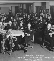
The Wornall Homestead Homes Association Annual Dinner on March 15, 1938.
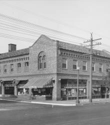
This picture was taken looking southwest at the intersection of Troost Avenue and 63rd Street. The pictured shopping center opened in October 1927.
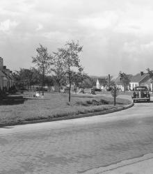
Around the corner view of a neighborhood found in the then-new Fairway housing development. The name was chosen because of the development's proximity to three golf courses. This vantage point faces south down Fairway Road from the intersection of U.S. Route 50 (now Shawnee Mission Parkway) and Fairway Road.
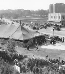
This picture of the Plaza Dog Mart was taken looking west-northwest from atop the J. C. Nichols Company Building. Country Club Plaza merchants sponsored a dog mart where people interested in buying a dog could see and inspect many breeds of dog. This dog mart was located at the future site of the Plaza Medical Building.
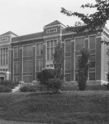
Northern exterior of E. C. White School, first public school in the Country Club District, once located at the northwest corner of 49th and Main Streets. This vantage point faces southeast on a portion of Brookside Boulevard now renamed Ward Parkway, just west of Main Street.
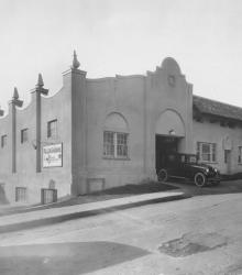
This picture of the Country Club Plaza Garage was taken looking southwest on 46th Terrace between Mill Creek Parkway (now J C Nichols Parkway) and Wyandotte Street. Country Club Plaza Garage with Mr. E. D. Barker in charge, housing space was provided for 144 cars. The garage was designed by Edward B. Delk.
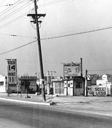
Northwest view from the southeast corner of U.S. Route 50 (now Shawnee Mission Parkway) and Belinder Road (now Belinder Avenue), showing a gas station.